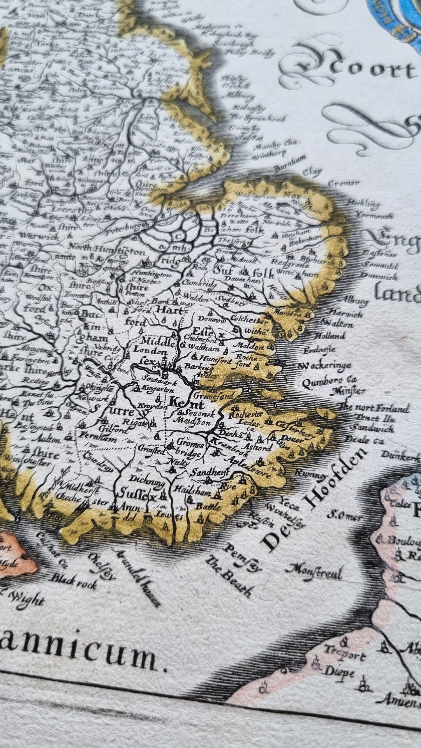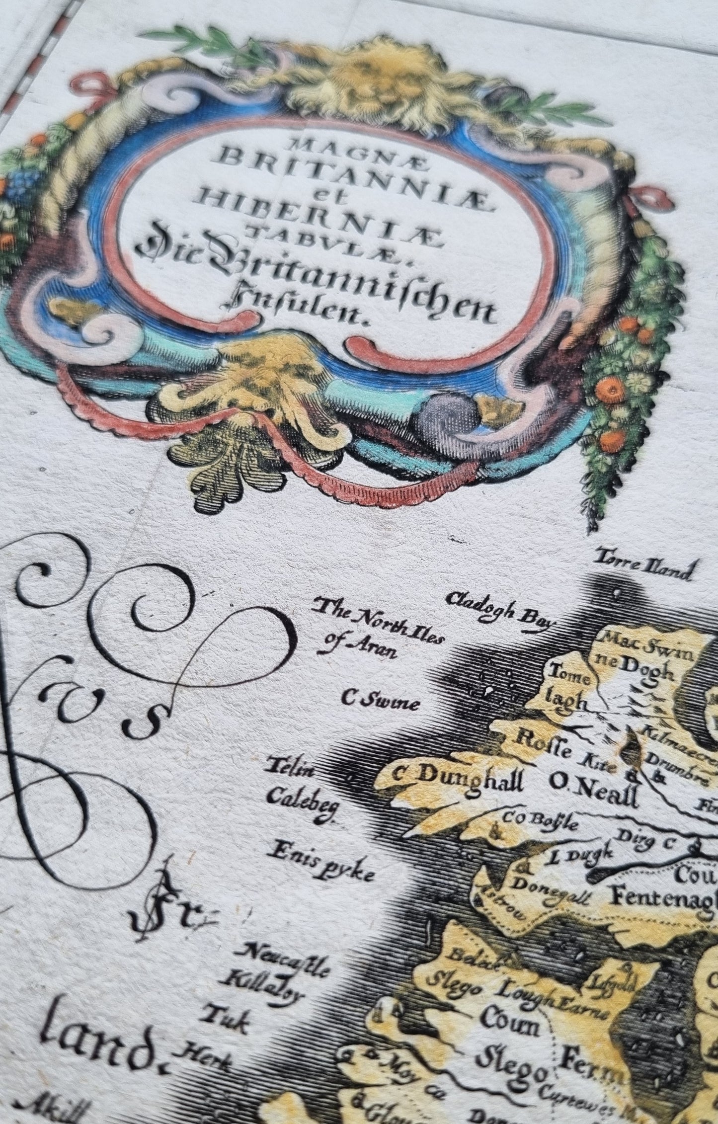


Beautiful antique map of Great Britain and Ireland from 1636, originally published by M. Merian in Frankfurt. Merian based this work on Blaeu's influential earlier map, adding a Stuart coat of arms in the North Sea.
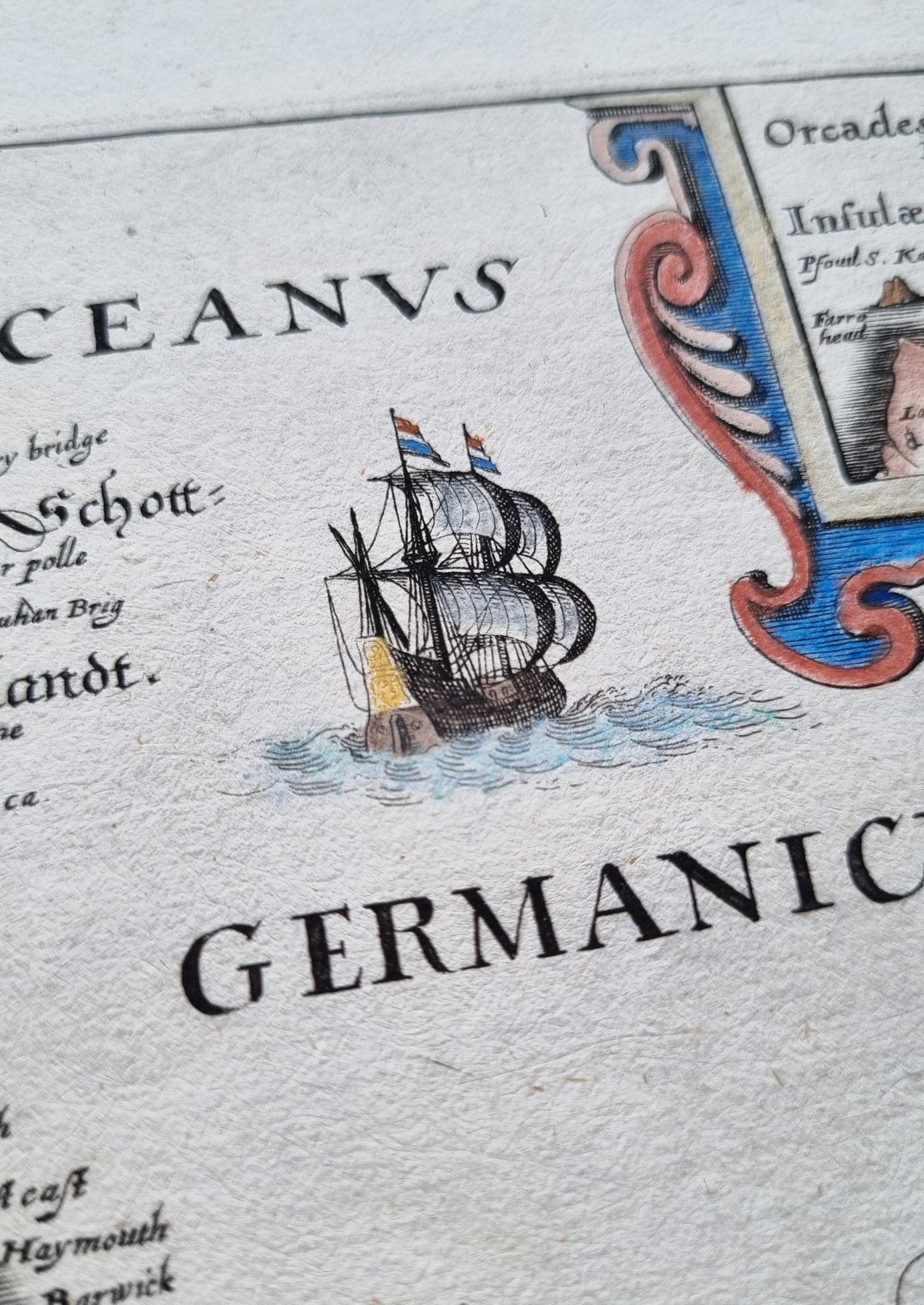
Attractively hand-coloured and filled with topographical details of England, Wales, Ireland and Scotland from the 17th Century. Enclosed in a strapwork cartouche and embellished with sailing ships, a compass rose and fine calligraphy
Details
- Date: 1636
- Author: Merian, M.; Frankfurt, Germany
- Size: 39.5cm x 31.5cm
Condition
Very Good; Clear printing and colour. Light soiling to edges not affecting the map face. Very small tears along bottom edge of vertical folders, archivally repaired.
Unframed.
1636 Great Britain and Ireland
1636 Great Britain and Ireland
Regular price
$490.00 AUD
Regular price
Sale price
$490.00 AUD
Unit price
per
Shipping calculated at checkout.
Couldn't load pickup availability
Out of stock
Beautiful antique map of Great Britain and Ireland from 1636, originally published by M. Merian in Frankfurt. Merian based this work on Blaeu's influential earlier map, adding a Stuart coat of arms in the North Sea.
Attractively hand-coloured and filled with topographical details of England, Wales, Ireland and Scotland from the 17th Century. Enclosed in a strapwork cartouche and embellished with sailing ships, a compass rose and fine calligraphy
Details
- Date: 1636
- Author: Merian, M.; Frankfurt, Germany
- Size: 39.5cm x 31.5cm
Condition
Very Good; Clear printing and colour. Light soiling to edges not affecting the map face. Very small tears along bottom edge of vertical folders, archivally repaired.
Unframed.