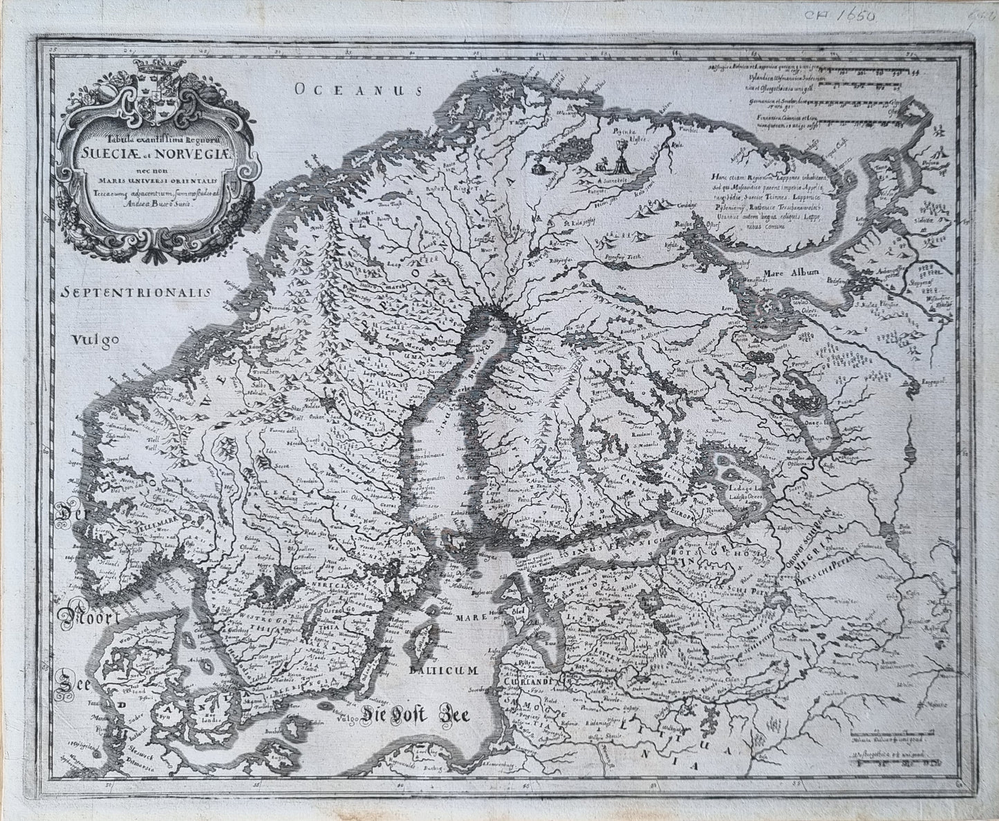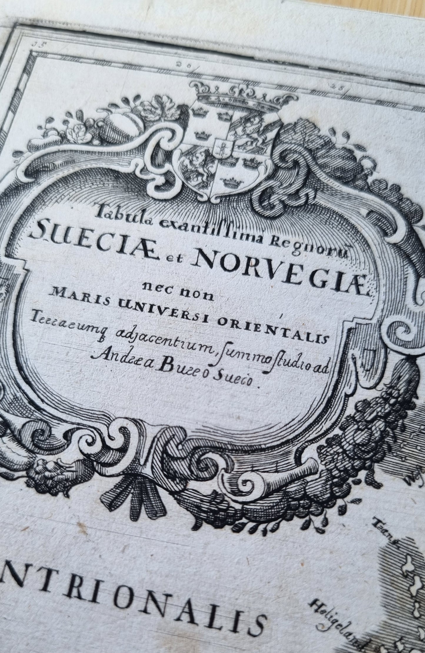


"Tabula exantissima Regnorum Sueciae et Norvegiae," a detailed representation of Sweden and Norway, meticulously crafted by Matthäus Merian, based on an earlier map by the renowned Swedish cartographer Anders Bure. Published in the mid-17th century, this map exemplifies the exquisite craftsmanship and geographical knowledge of Scandenavia by Bure, which was replicated by Merian, Blaeu and others for more than a century.
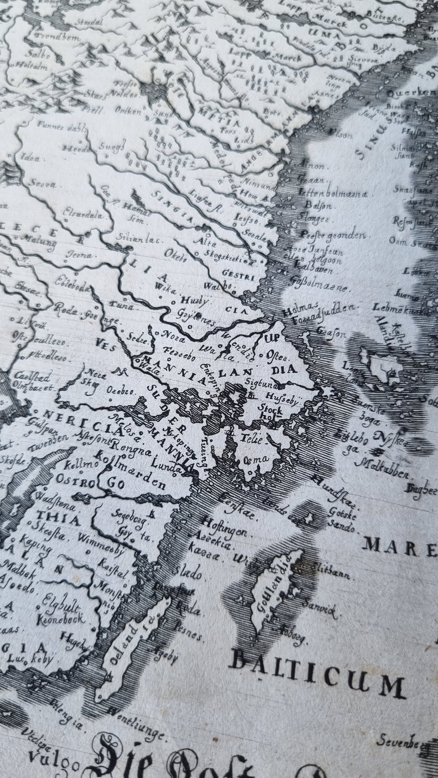
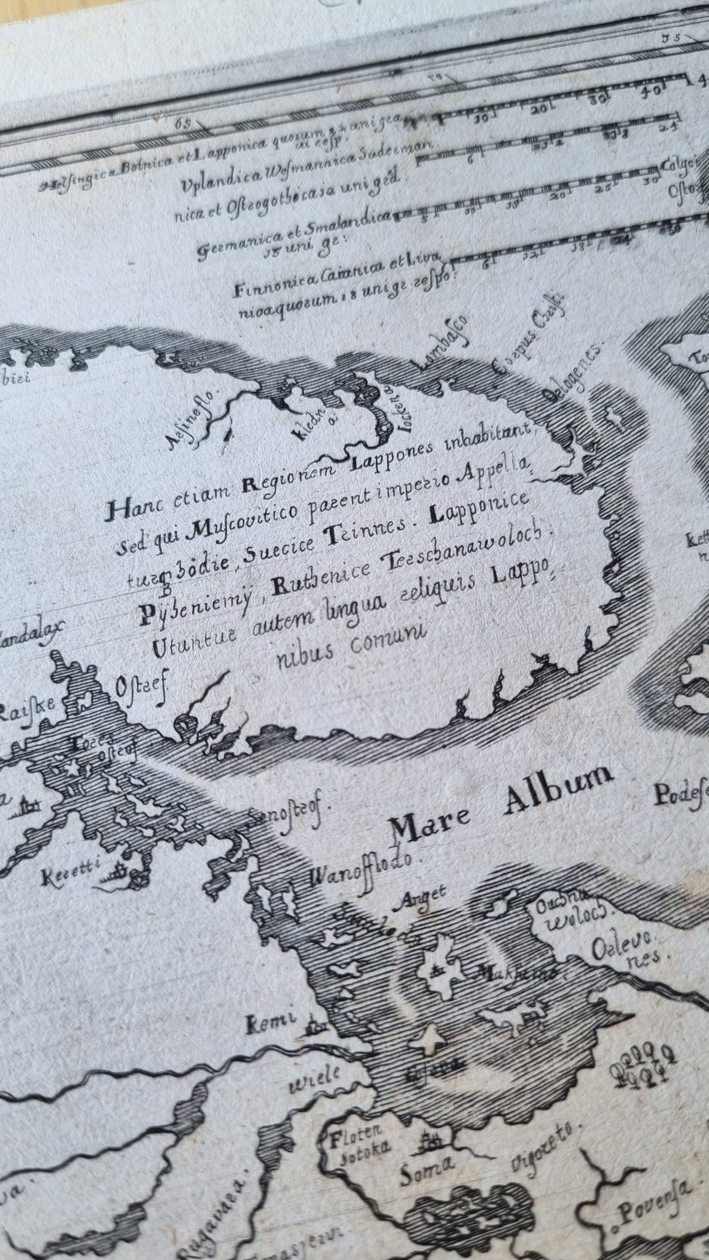
The map is rich with geographical details, including rivers, mountains, forests, and numerous towns and settlements, each carefully labelled. The elaborate cartouche is adorned with intricate decorations and the Swedish coat of arms. The inclusion of various regions inhabited by the Sami people, referred to as "Lappones," highlights the cultural and ethnic diversity of the area and descriptive text in Latin sheds light on the political and social landscape of the time.
Collectors will find this map particularly appealing due to its historical significance and the exceptional quality of Merian's engraving work. The map not only serves as a visual record of the Scandinavian region during the 17th century but also reflects the advanced cartographic techniques and artistic sensibilities of the period. Its rarity and well-preserved condition, still uncoloured with clear dark print, makes it a prized addition to any collection of Scandinavian maps
Details
- Date: 1650
- Author: Merian, M.; Frankfurt, Germany
- Size: 36cm x 29cm
Condition
Excellent; Clear, dark print. Margins have been recently archivally repaired and reinforced. Unframed
1650 Norway and Sweden
1650 Norway and Sweden
Couldn't load pickup availability
1 in stock
"Tabula exantissima Regnorum Sueciae et Norvegiae," a detailed representation of Sweden and Norway, meticulously crafted by Matthäus Merian, based on an earlier map by the renowned Swedish cartographer Anders Bure. Published in the mid-17th century, this map exemplifies the exquisite craftsmanship and geographical knowledge of Scandenavia by Bure, which was replicated by Merian, Blaeu and others for more than a century.
The map is rich with geographical details, including rivers, mountains, forests, and numerous towns and settlements, each carefully labelled. The elaborate cartouche is adorned with intricate decorations and the Swedish coat of arms. The inclusion of various regions inhabited by the Sami people, referred to as "Lappones," highlights the cultural and ethnic diversity of the area and descriptive text in Latin sheds light on the political and social landscape of the time.
Collectors will find this map particularly appealing due to its historical significance and the exceptional quality of Merian's engraving work. The map not only serves as a visual record of the Scandinavian region during the 17th century but also reflects the advanced cartographic techniques and artistic sensibilities of the period. Its rarity and well-preserved condition, still uncoloured with clear dark print, makes it a prized addition to any collection of Scandinavian maps
Details
- Date: 1650
- Author: Merian, M.; Frankfurt, Germany
- Size: 36cm x 29cm
Condition
Excellent; Clear, dark print. Margins have been recently archivally repaired and reinforced. Unframed