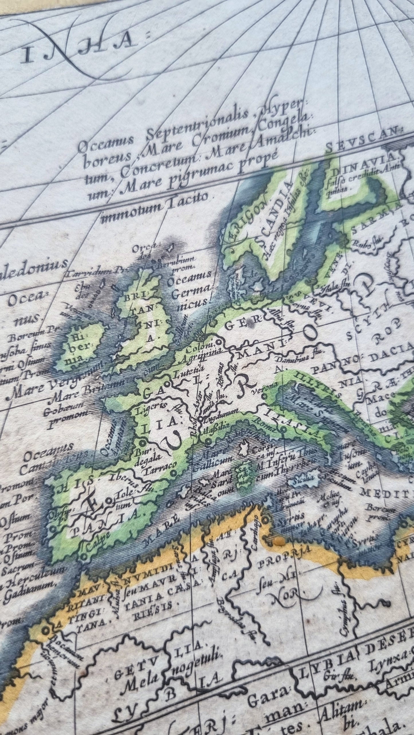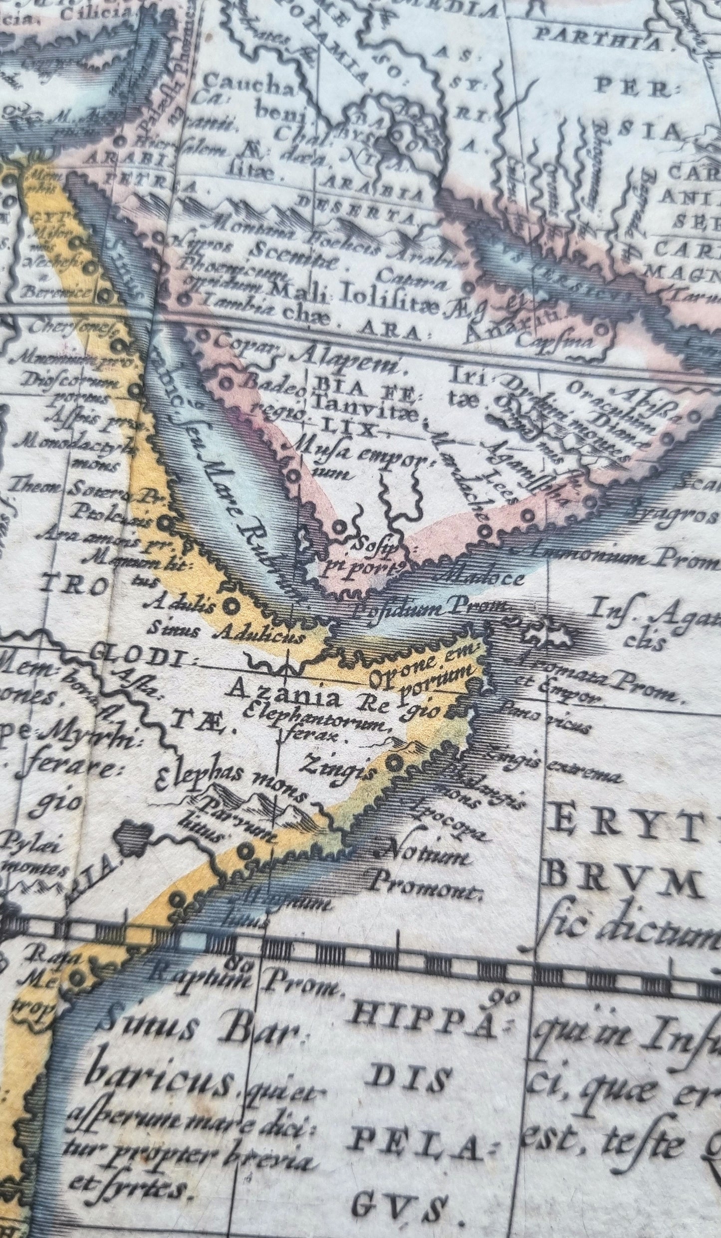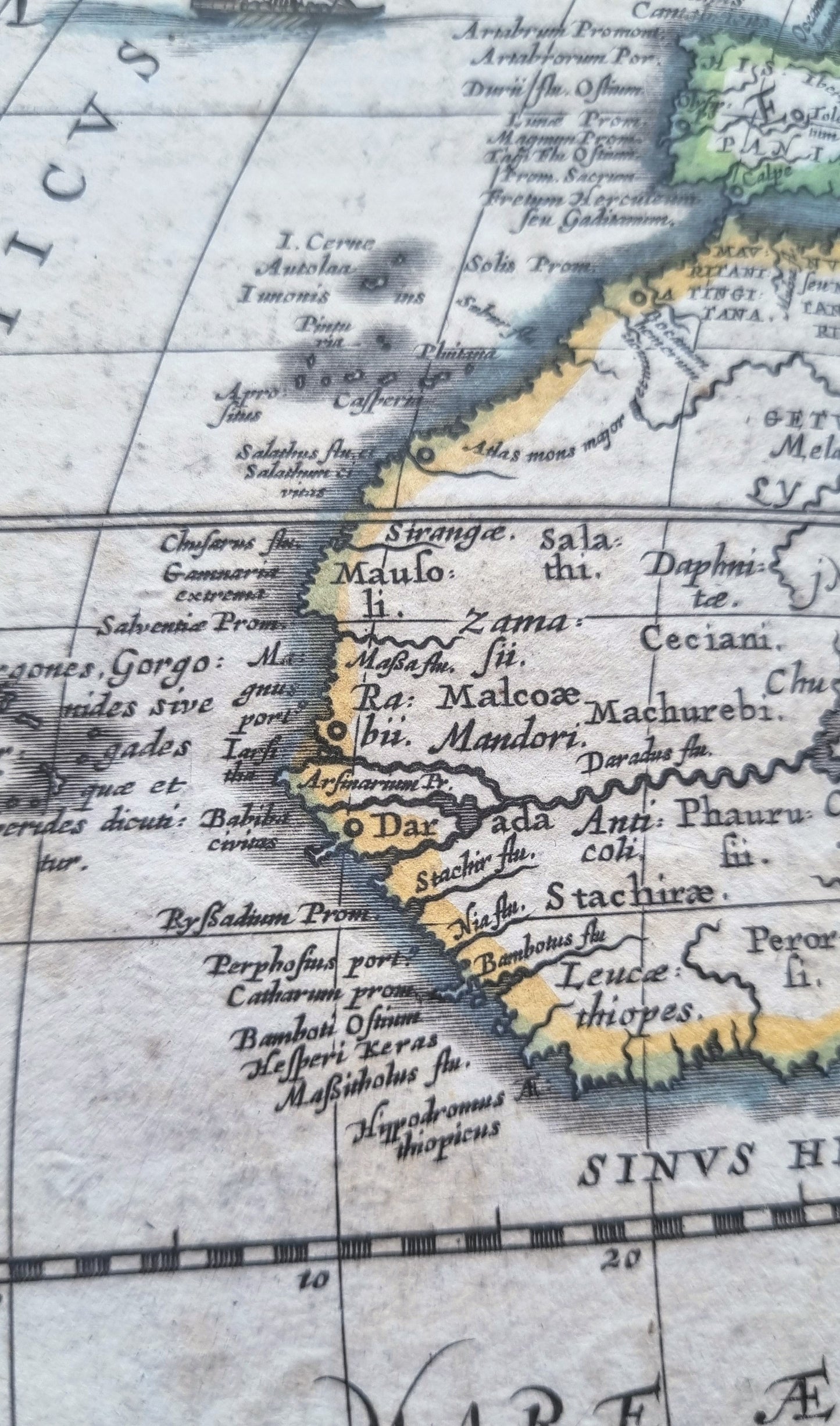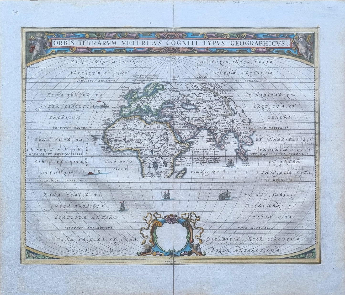


A striking world map of ancient history "Orbis Terrarum Veteribus Cogniti Typus Geographicus" by Johannes Janssonius, originally published in "Atlantis Majoris Part V" in 1650. A blend of history, mythology and speculation of earlier world maps, with the emerging Dutch cartographic science of the Late Renaissance.
The map represents a Europe-centric view of the ancient world, based on earlier historical maps by Ortelius, and restricted to the lands known by Ptolemy. The Mediterranean Sea is centrally located and well-detailed, reflecting its importance in ancient times as a hub of trade, cultural exchange and war. In Africa, the Nile is prominently featured, exaggerated in length and with more branches than it has, due to its significance in ancient geography. Besides the Nile, other major rivers such as the Danube, the Euphrates, and the Tigris are included, which were important in ancient times.
Notably the recent discoveries of the New World, the East coast of China and lands in the Southern Hemisphere are excluded. All five climatic zones are labelled, the frigid zones in the north and south, as well as the temperate zones and the tropics.
The map itself is beautifully adorned with intricate calligraphy and details that are typical of the golden age of Dutch cartography. The hand-colored decorations, ships, a sea-monster, the ornate cartouche and title adorned by cherubs, all add to its aesthetic appeal.
Text in Latin. Verso in Dutch. The cartouche at the bottom is left blank, indicating the first state (Shirley 385).
Details
- Date: 1650
- Author: Johannes Janssonius; Amsterdam, Holland
- Size: 51cm x 40cm
Condition
Very Good; Dark print with bright contemporary colouring. Light soiling from age. The text on verso can be seen showing through the paper in some places. Two tears in the centre-fold, extending about 5cm from the top and bottom of the map have been archivally repaired. Minor tears to the margin edges have also been repaired. Original text on verso.
Unframed.
1650 Orbis Terrarum
1650 Orbis Terrarum
Couldn't load pickup availability
1 in stock
A striking world map of ancient history "Orbis Terrarum Veteribus Cogniti Typus Geographicus" by Johannes Janssonius, originally published in "Atlantis Majoris Part V" in 1650. A blend of history, mythology and speculation of earlier world maps, with the emerging Dutch cartographic science of the Late Renaissance.
The map represents a Europe-centric view of the ancient world, based on earlier historical maps by Ortelius, and restricted to the lands known by Ptolemy. The Mediterranean Sea is centrally located and well-detailed, reflecting its importance in ancient times as a hub of trade, cultural exchange and war. In Africa, the Nile is prominently featured, exaggerated in length and with more branches than it has, due to its significance in ancient geography. Besides the Nile, other major rivers such as the Danube, the Euphrates, and the Tigris are included, which were important in ancient times.
Notably the recent discoveries of the New World, the East coast of China and lands in the Southern Hemisphere are excluded. All five climatic zones are labelled, the frigid zones in the north and south, as well as the temperate zones and the tropics.
The map itself is beautifully adorned with intricate calligraphy and details that are typical of the golden age of Dutch cartography. The hand-colored decorations, ships, a sea-monster, the ornate cartouche and title adorned by cherubs, all add to its aesthetic appeal.
Text in Latin. Verso in Dutch. The cartouche at the bottom is left blank, indicating the first state (Shirley 385).
Details
- Date: 1650
- Author: Johannes Janssonius; Amsterdam, Holland
- Size: 51cm x 40cm
Condition
Very Good; Dark print with bright contemporary colouring. Light soiling from age. The text on verso can be seen showing through the paper in some places. Two tears in the centre-fold, extending about 5cm from the top and bottom of the map have been archivally repaired. Minor tears to the margin edges have also been repaired. Original text on verso.
Unframed.