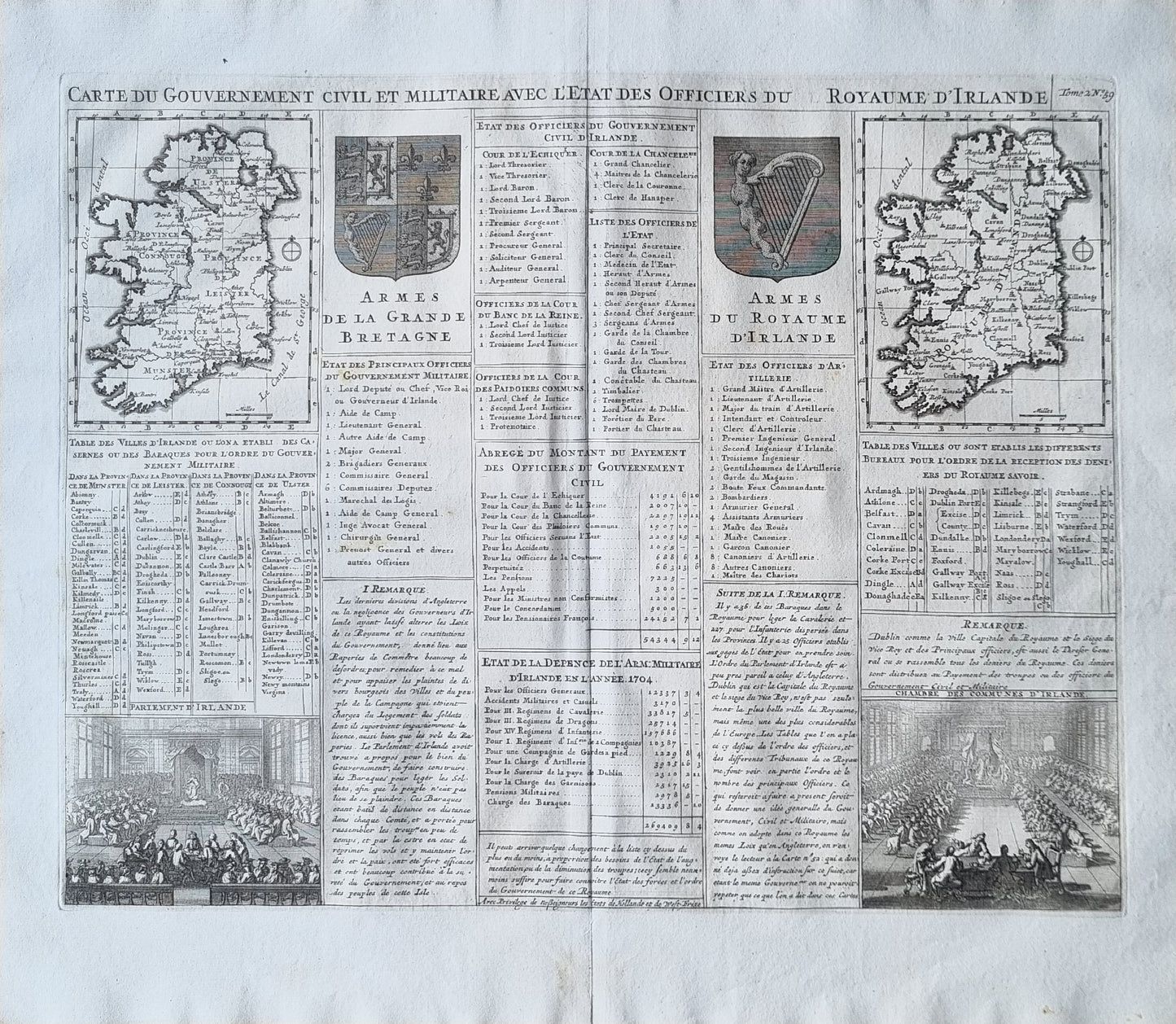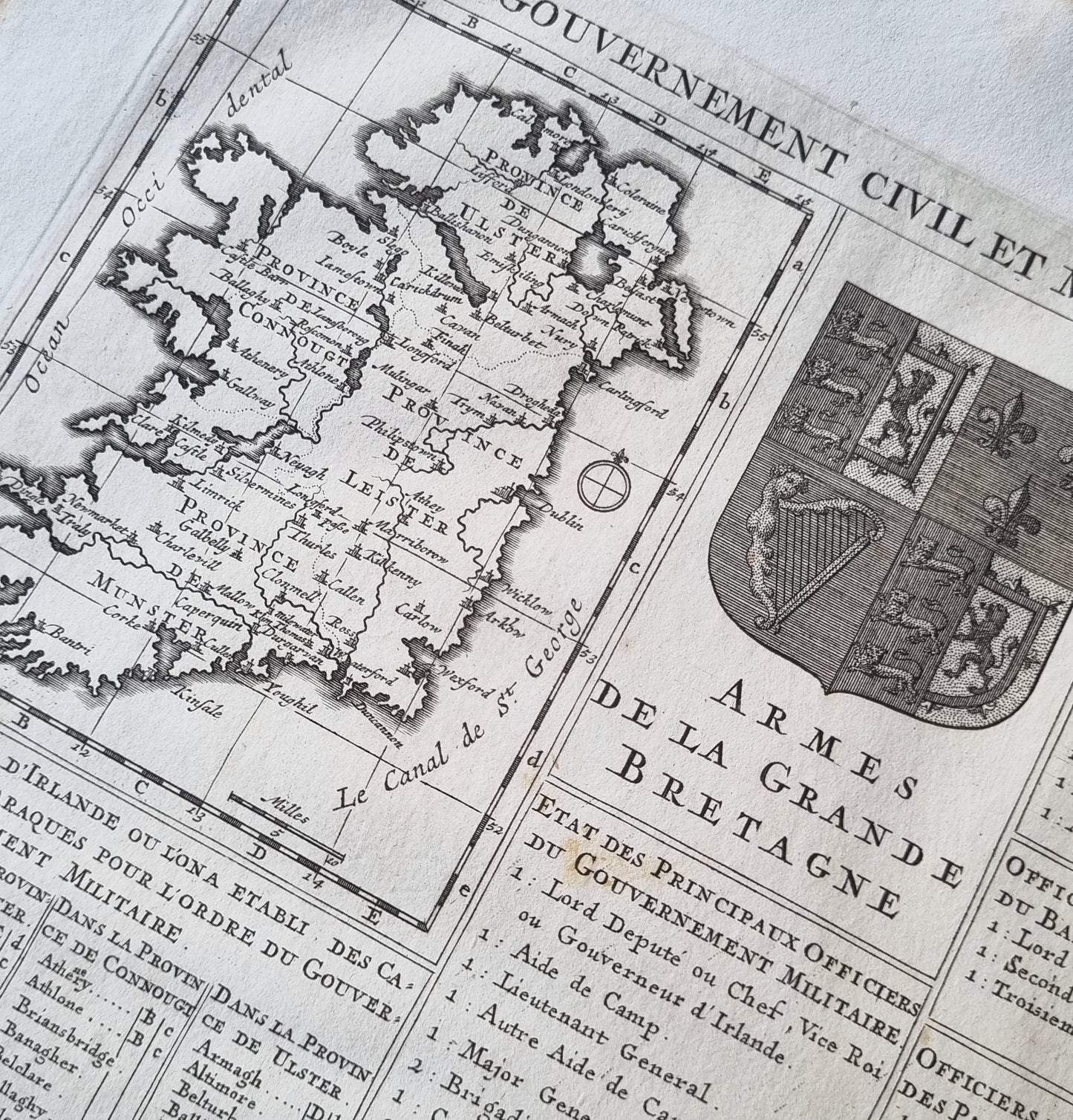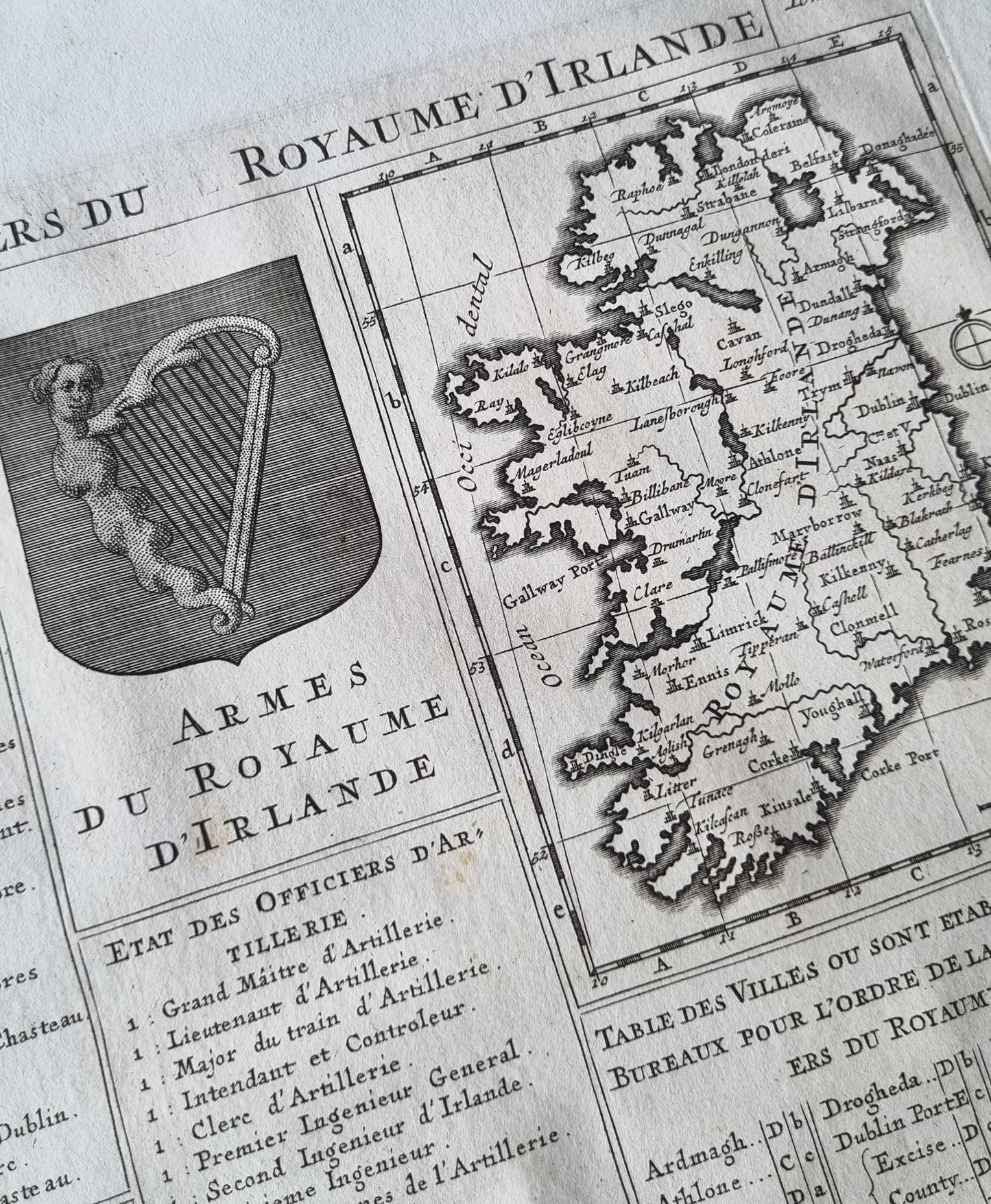


"Carte du Gouvernement Civil et Militaire avec l'Etat des Officiers du Royaume d'Irlande," produced by Henri Abraham Chatelain in 1720 as part of his "Atlas Historique," provides a detailed portrayal of Ireland during the early 18th century. This map is distinguished by its dual focus on both the civil and military aspects of Irish governance, showcasing the intricate administrative and military structures established under British rule. The map features a detailed listing of government officers and their roles, alongside a meticulous depiction of Ireland, highlighting major cities, towns, and geographical features.
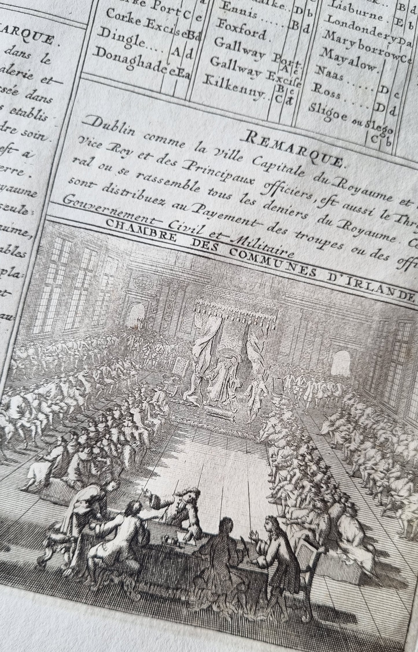
Aesthetically, the map is richly decorated with heraldic emblems, including the "Armes de la Grande Bretagne" and the "Armes du Royaume d'Irlande," which are prominently displayed, symbolizing the political union and control exerted by Great Britain over Ireland. The map is further enhanced by detailed vignettes depicting key elements of governmental and military life, such as meetings in the Irish Parliament and various military engagements.
The map encapsulates Ireland's administrative and military state post the 1707 Acts of Union, offering insights into the complexities of British-Irish relations during a turbulent period in history.
Details
- Date: 1720
- Author: Chatelain, Henri; Amsterdam, Holland
- Size: 50cm x 43cm
Condition
Very Good. Dark, clear print, wide margins. Centre-fold as issued.
Unframed
1720 Irish Governance by Chatelain
1720 Irish Governance by Chatelain
Couldn't load pickup availability
1 in stock
"Carte du Gouvernement Civil et Militaire avec l'Etat des Officiers du Royaume d'Irlande," produced by Henri Abraham Chatelain in 1720 as part of his "Atlas Historique," provides a detailed portrayal of Ireland during the early 18th century. This map is distinguished by its dual focus on both the civil and military aspects of Irish governance, showcasing the intricate administrative and military structures established under British rule. The map features a detailed listing of government officers and their roles, alongside a meticulous depiction of Ireland, highlighting major cities, towns, and geographical features.
Aesthetically, the map is richly decorated with heraldic emblems, including the "Armes de la Grande Bretagne" and the "Armes du Royaume d'Irlande," which are prominently displayed, symbolizing the political union and control exerted by Great Britain over Ireland. The map is further enhanced by detailed vignettes depicting key elements of governmental and military life, such as meetings in the Irish Parliament and various military engagements.
The map encapsulates Ireland's administrative and military state post the 1707 Acts of Union, offering insights into the complexities of British-Irish relations during a turbulent period in history.
Details
- Date: 1720
- Author: Chatelain, Henri; Amsterdam, Holland
- Size: 50cm x 43cm
Condition
Very Good. Dark, clear print, wide margins. Centre-fold as issued.
Unframed