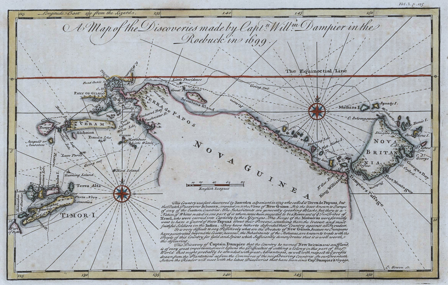

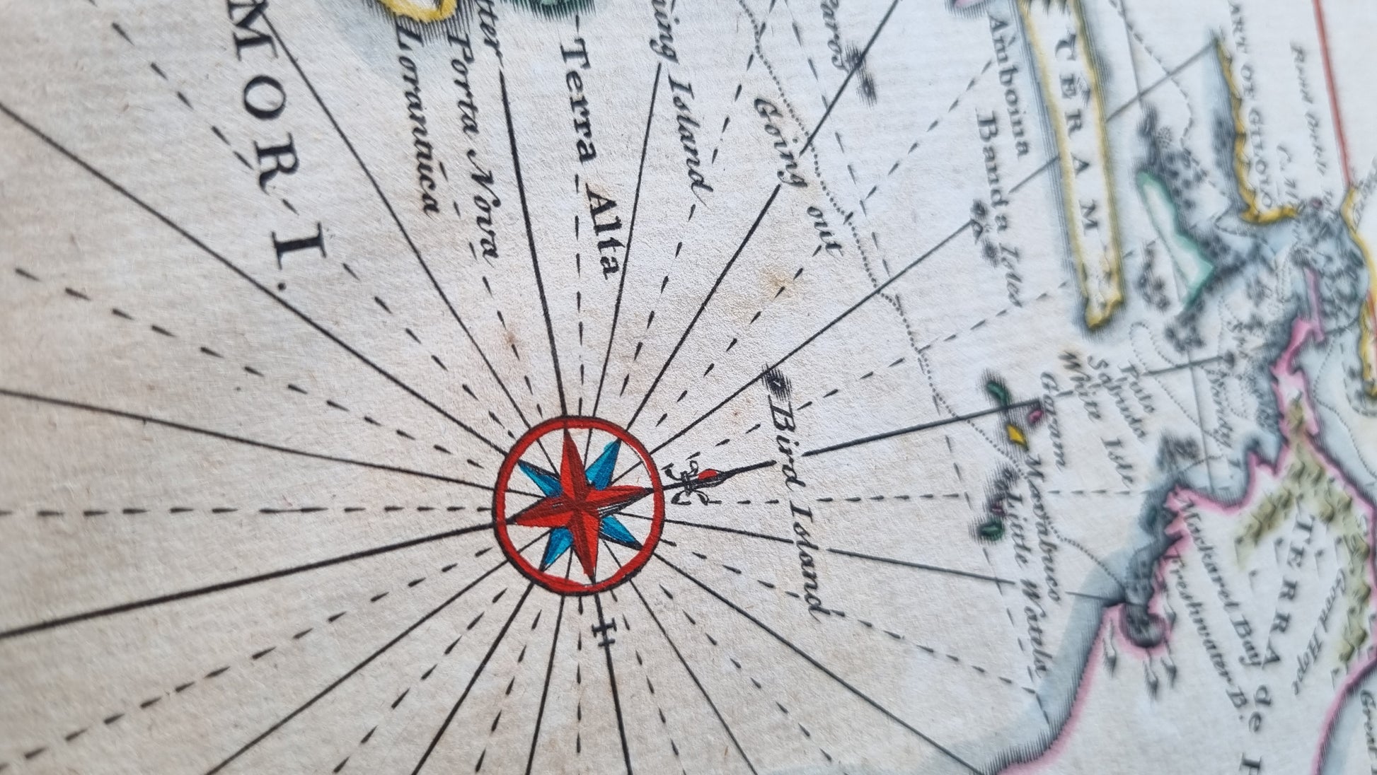


A Map of the Discoveries by Captain William Dampier in the Roebuck in 1699 by Emanuel Bowen, published in 1740 and featuring the coastline of New Guinea and surrounding islands, including New Britain, Timor and the Banda Islands. It includes detailed notations on the route of the Roebuck, significant landmarks, and annotations describing the characteristics of the lands and their inhabitants.
Emanuel Bowen was appointed as mapmaker to both George II of England and Louis XV of France and is best known amongst collectors for his "A Complete Map of the Southern Continent", one of the first large-scale maps in English of Australia as known to Europeans and before exploration by Cook. This map of New Guinea was prepared for the same publication and shares the same style and features as Bowen's most famous work.
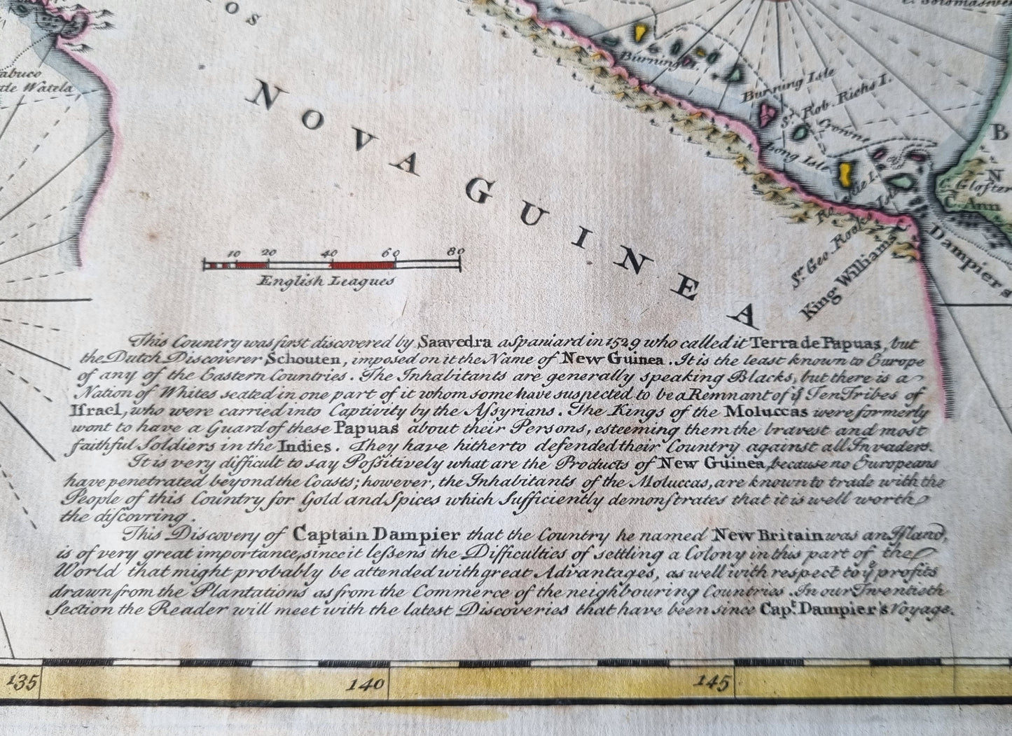
A particularly fascinating excerpt reads "The inhabitants are generally speaking Blacks, but there is a Nation of Whites seated in one part of it whom some have suspected to be a remnant of the Ten Tribes of Israel, who were carried into captivity by the Assyrians..." Although such observations have generally been attributed to myth, the Gogodala people of Western Papua New Guinea themselves do in fact claim to be ancestors of a Lost Tribe of Israel and continue to practice a form of Judaism to this day.
Details
- Date: 1740
- Author: Bowen, E.; London, England
- Size: 32cm x 20cm
Condition
Excellent; Dark print with wide margins on strong paper. Subtle contemporary hand-colour. Very slight toning and occasional spots. Unframed
1744 New Guinea - Discoveries by William Dampier
1744 New Guinea - Discoveries by William Dampier
Couldn't load pickup availability
1 in stock
A Map of the Discoveries by Captain William Dampier in the Roebuck in 1699 by Emanuel Bowen, published in 1740 and featuring the coastline of New Guinea and surrounding islands, including New Britain, Timor and the Banda Islands. It includes detailed notations on the route of the Roebuck, significant landmarks, and annotations describing the characteristics of the lands and their inhabitants.
Emanuel Bowen was appointed as mapmaker to both George II of England and Louis XV of France and is best known amongst collectors for his "A Complete Map of the Southern Continent", one of the first large-scale maps in English of Australia as known to Europeans and before exploration by Cook. This map of New Guinea was prepared for the same publication and shares the same style and features as Bowen's most famous work.
A particularly fascinating excerpt reads "The inhabitants are generally speaking Blacks, but there is a Nation of Whites seated in one part of it whom some have suspected to be a remnant of the Ten Tribes of Israel, who were carried into captivity by the Assyrians..." Although such observations have generally been attributed to myth, the Gogodala people of Western Papua New Guinea themselves do in fact claim to be ancestors of a Lost Tribe of Israel and continue to practice a form of Judaism to this day.
Details
- Date: 1740
- Author: Bowen, E.; London, England
- Size: 32cm x 20cm
Condition
Excellent; Dark print with wide margins on strong paper. Subtle contemporary hand-colour. Very slight toning and occasional spots. Unframed