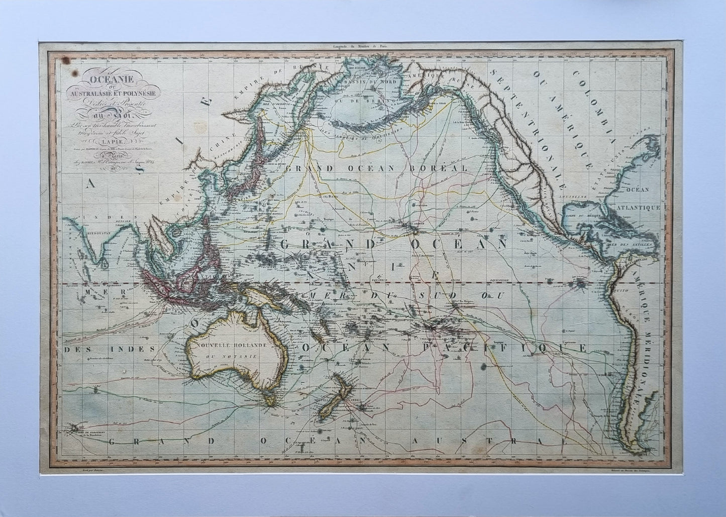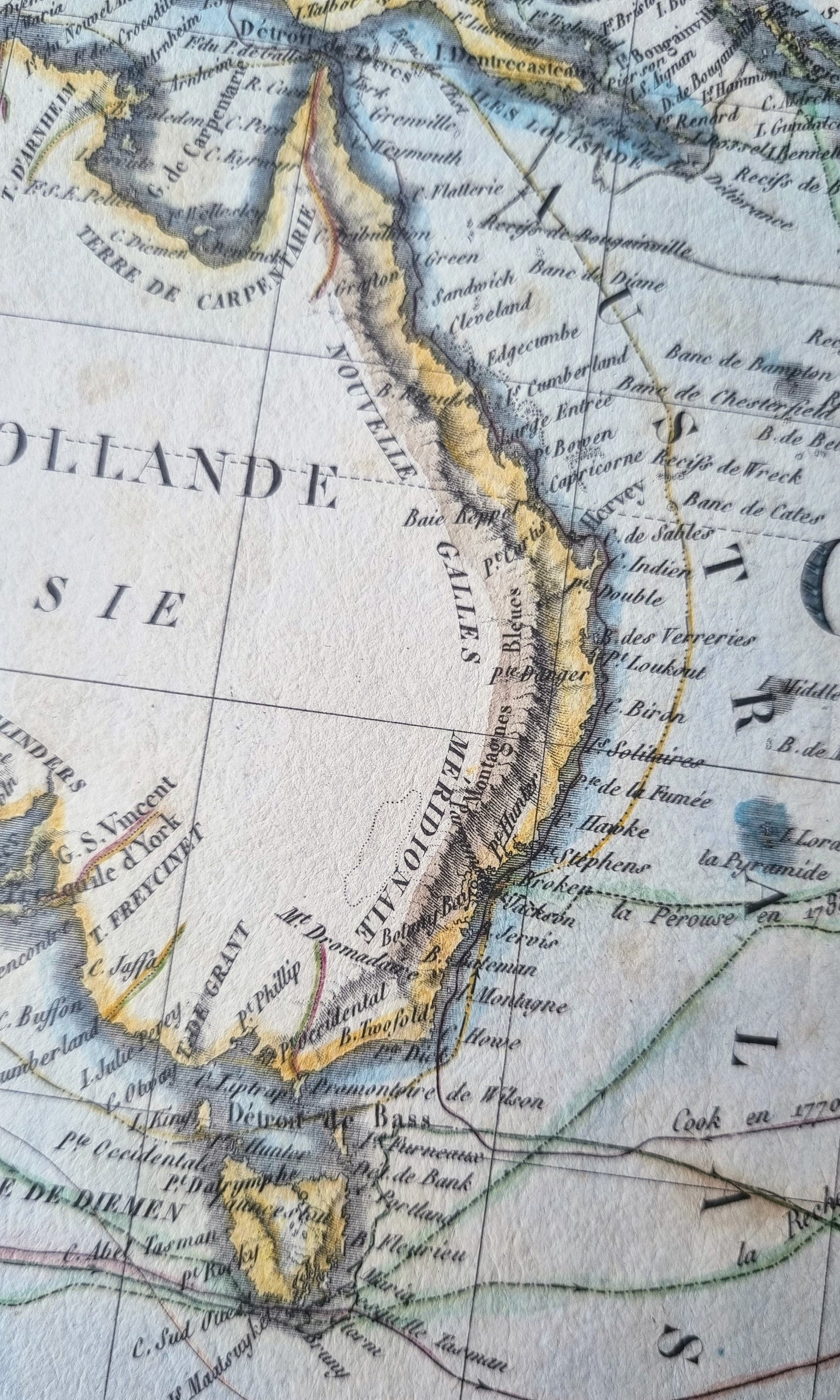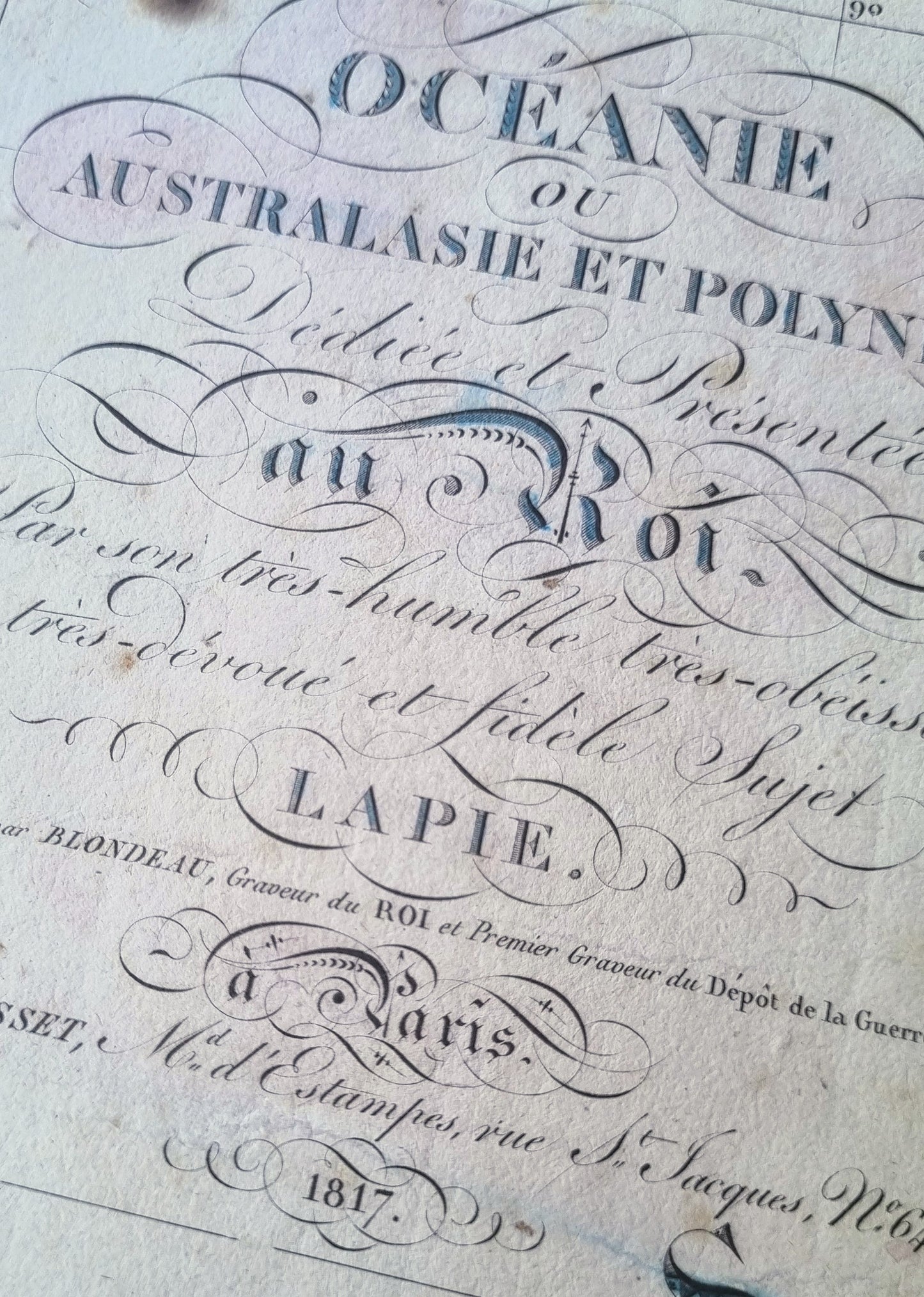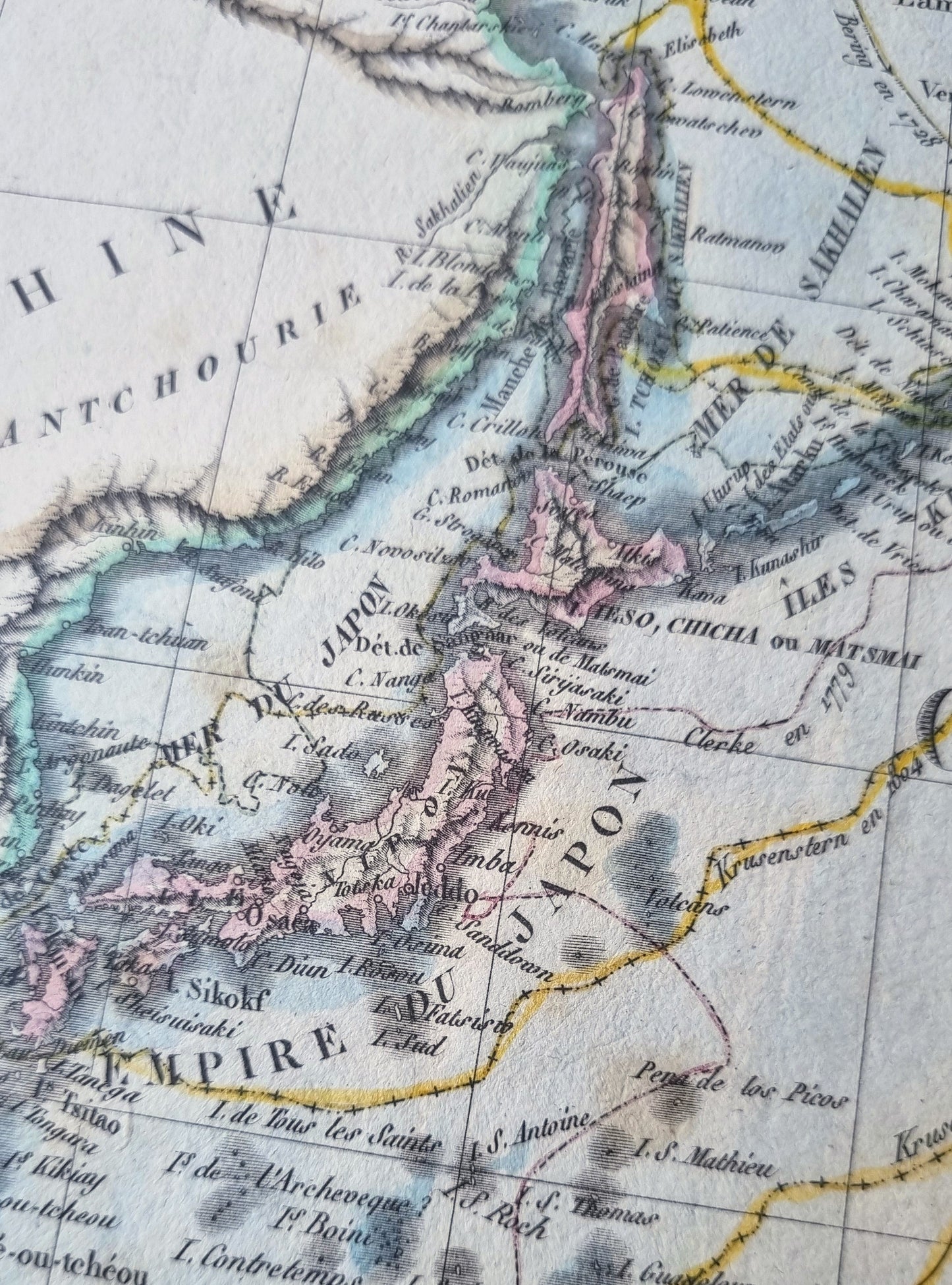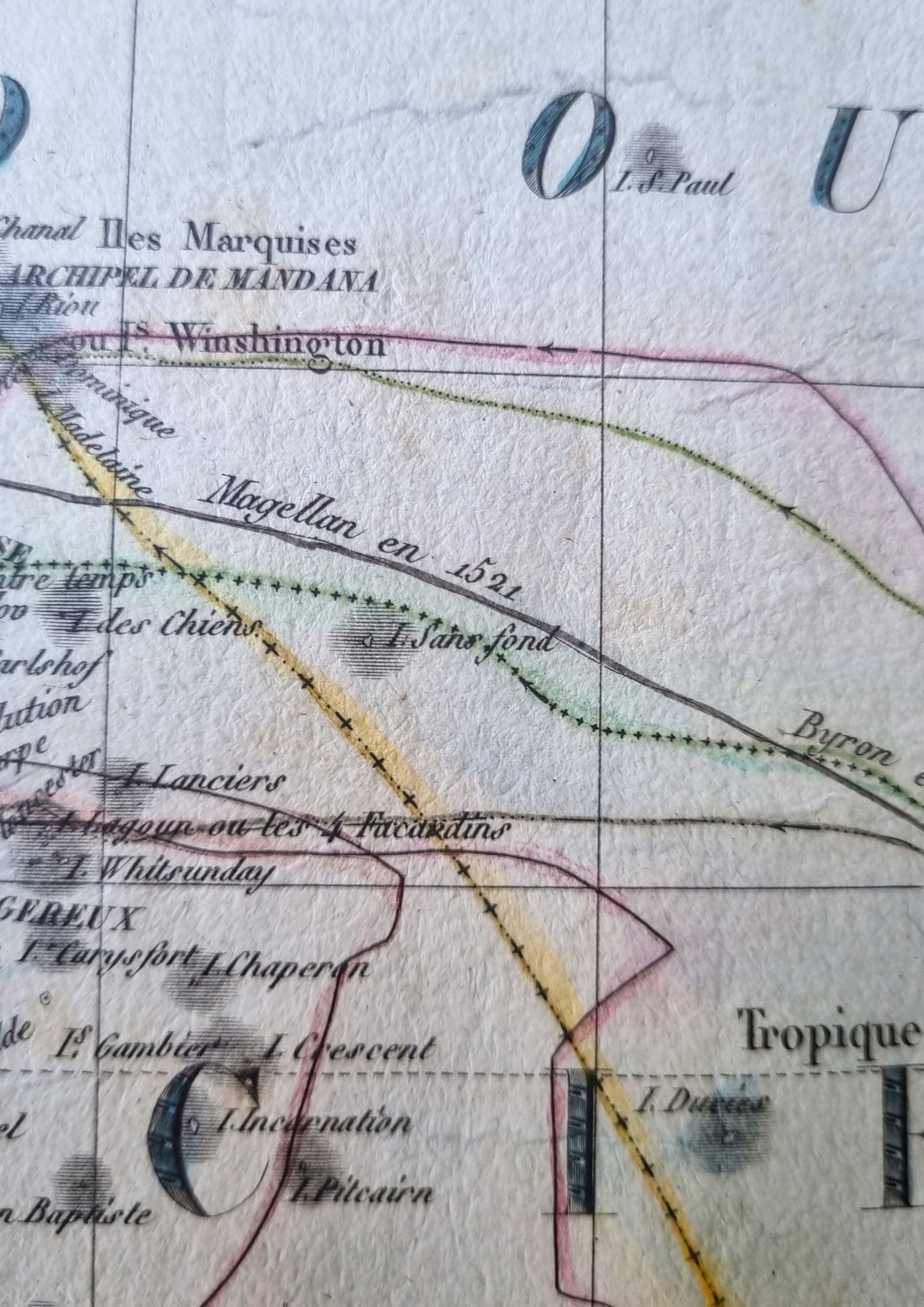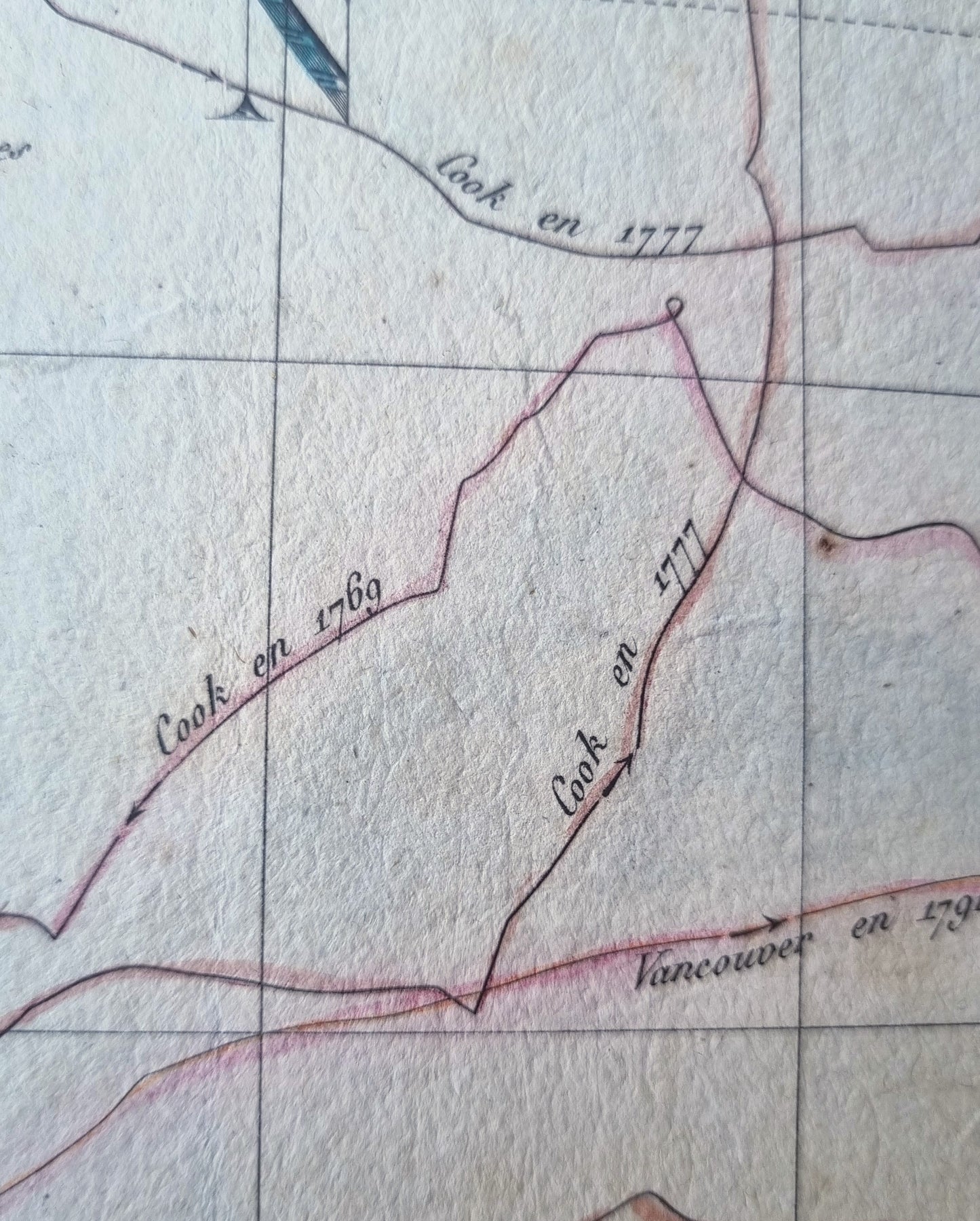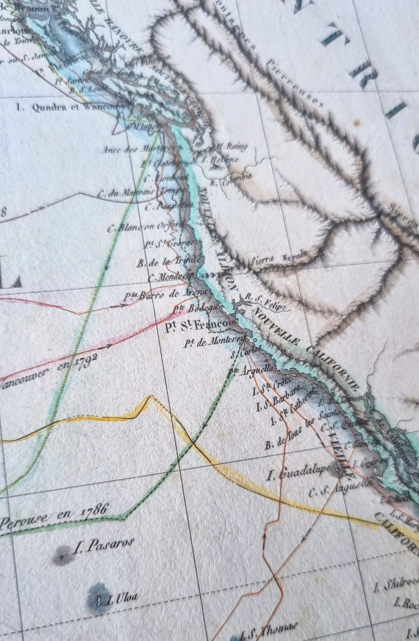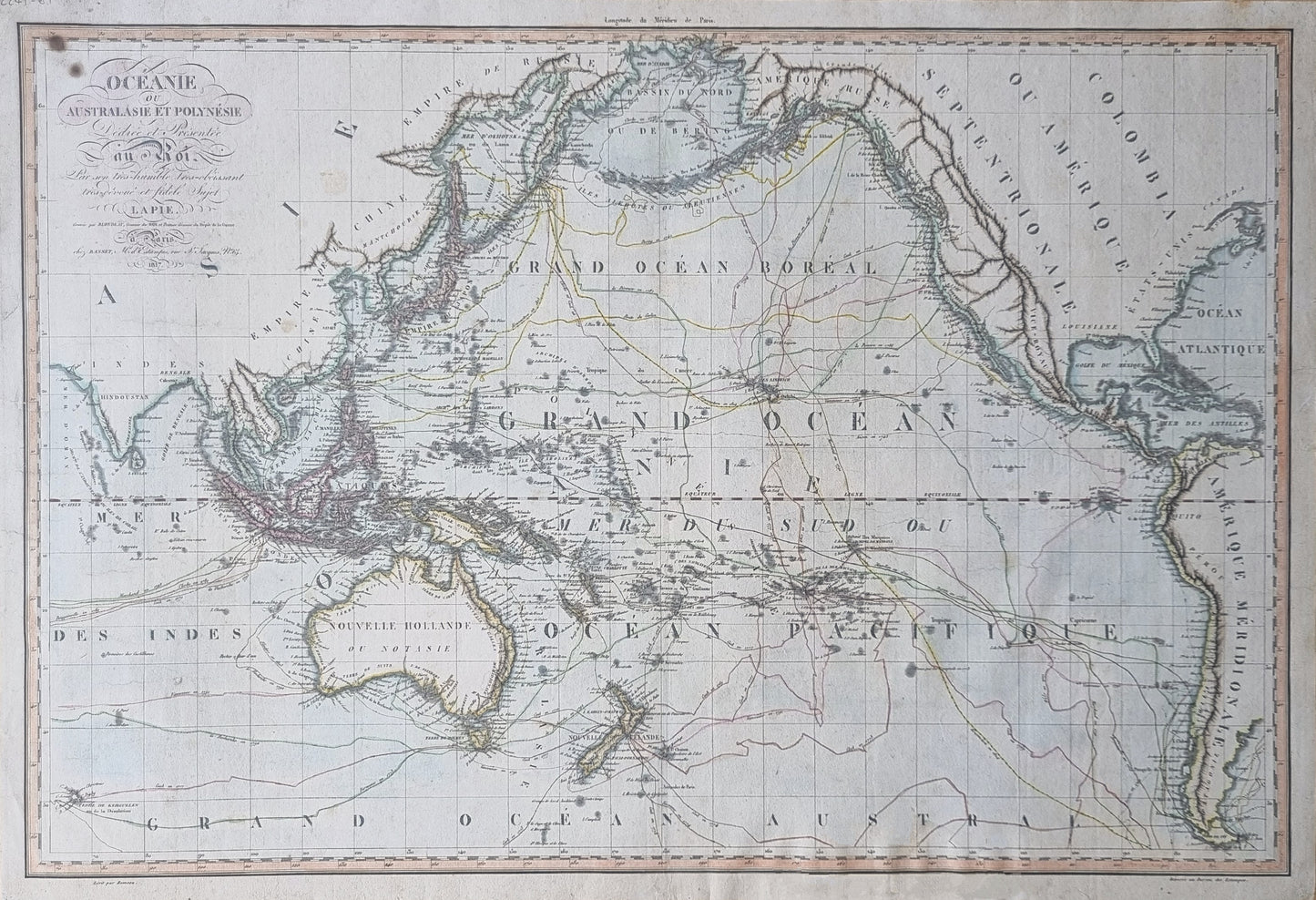


"Océanie ou Australasie et Polynésie" by Pierre M. Lapie, published in 1817. Shows the world during the Age of Exploration, tracing the ambitious voyages of explorers like Magellan, Cook and Vancouver.
Lapie, as geographer to the King Louis XVIII, presents work that is both precise and artistic, with topographical features, sea-routes and political boundaries articulated with clarity and subtle coloration. Meticulous calligraphy, especially in the title and legends, showcases the stylistic preferences of early 19th-century France.
Routes include the voyages of:
- Magellan 1521
- Bering 1741
- Anson 1743
- Byron 1765
- Bougainville, 1769
- Cook, 1773, 1769, 1777, 1778
- Furneau, 1773
- Clerke, 1780
- La Perouse, 1786
- Marchang, 1791
- La Recherche, 1792, 1795
- Vancouver, 1791, 1793, 1794
- Flinders, 1803
- Krusenstern, 1804, 1805
An endlessly interesting early 19th Century map depicting the Age of Exploration. Imperfect but highly detailed and coloured. Large form and would display beautifully when framed.
Details
- Date: 1817
- Author: Pierre Lapie; Paris, France
- Size: 75cm x 49cm
Condition
Good; Dark print with good colour. Light soiling from age. Two dark spots at top-left corner of the map within the neat-line.
Unframed.
1817 Oceanie (detailing voyages of explorers)
1817 Oceanie (detailing voyages of explorers)
Regular price
$590.00 AUD
Regular price
Sale price
$590.00 AUD
Unit price
per
Shipping calculated at checkout.
Couldn't load pickup availability
Out of stock
"Océanie ou Australasie et Polynésie" by Pierre M. Lapie, published in 1817. Shows the world during the Age of Exploration, tracing the ambitious voyages of explorers like Magellan, Cook and Vancouver.
Lapie, as geographer to the King Louis XVIII, presents work that is both precise and artistic, with topographical features, sea-routes and political boundaries articulated with clarity and subtle coloration. Meticulous calligraphy, especially in the title and legends, showcases the stylistic preferences of early 19th-century France.
Routes include the voyages of:
- Magellan 1521
- Bering 1741
- Anson 1743
- Byron 1765
- Bougainville, 1769
- Cook, 1773, 1769, 1777, 1778
- Furneau, 1773
- Clerke, 1780
- La Perouse, 1786
- Marchang, 1791
- La Recherche, 1792, 1795
- Vancouver, 1791, 1793, 1794
- Flinders, 1803
- Krusenstern, 1804, 1805
An endlessly interesting early 19th Century map depicting the Age of Exploration. Imperfect but highly detailed and coloured. Large form and would display beautifully when framed.
Details
- Date: 1817
- Author: Pierre Lapie; Paris, France
- Size: 75cm x 49cm
Condition
Good; Dark print with good colour. Light soiling from age. Two dark spots at top-left corner of the map within the neat-line.
Unframed.