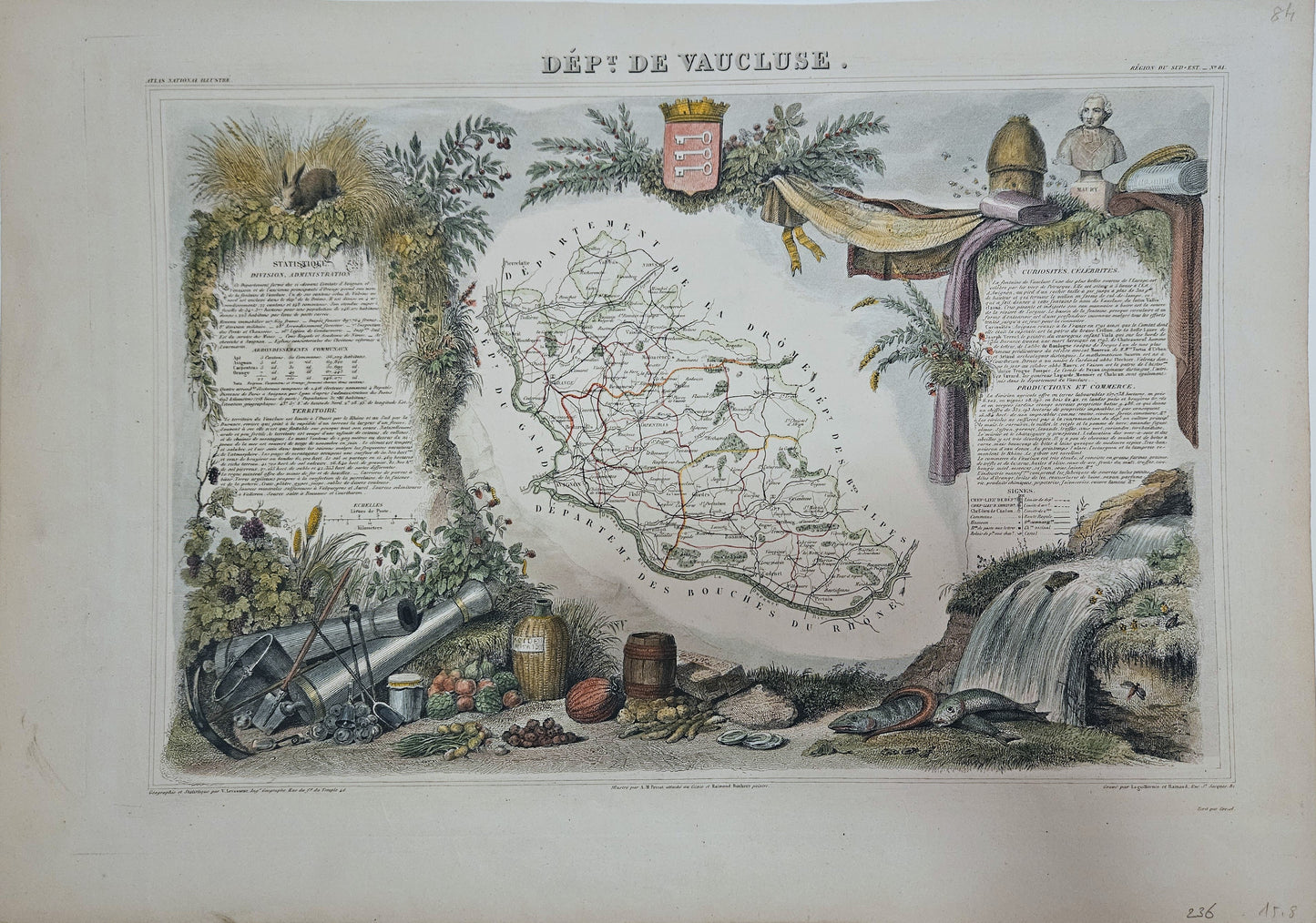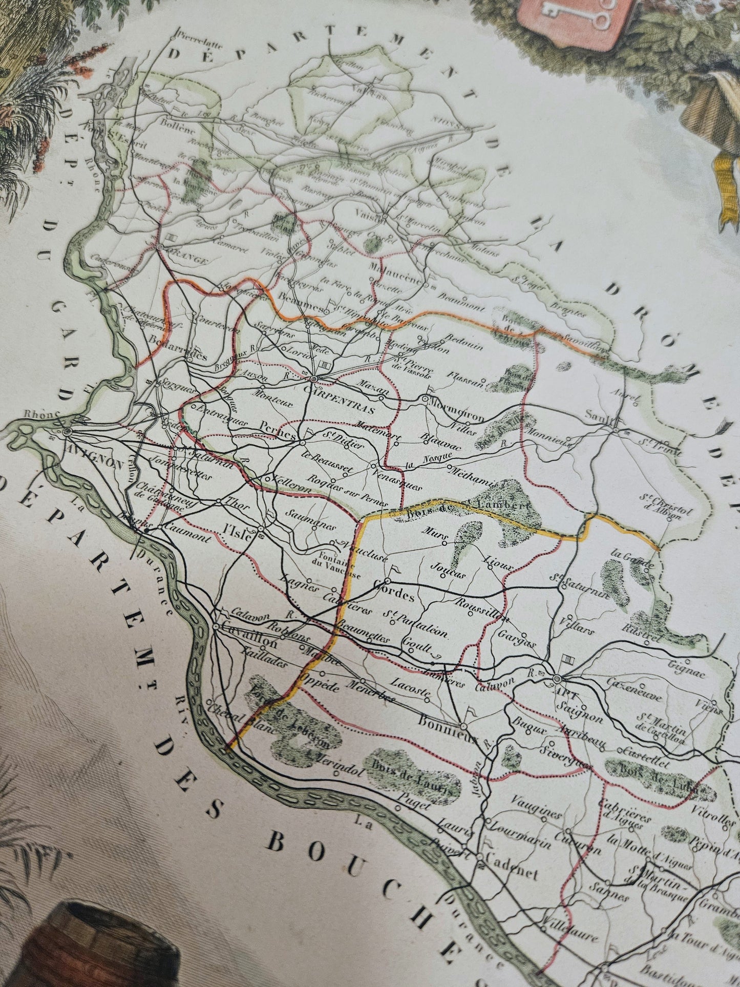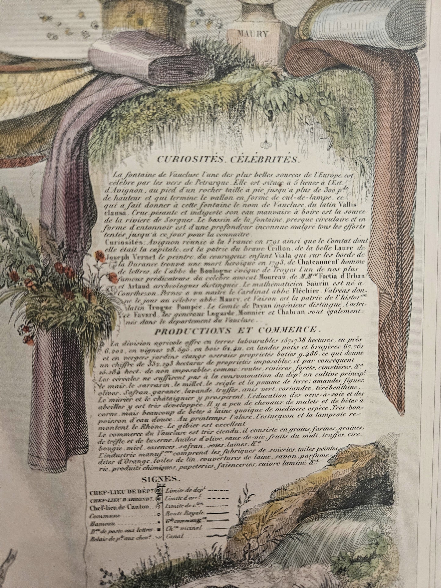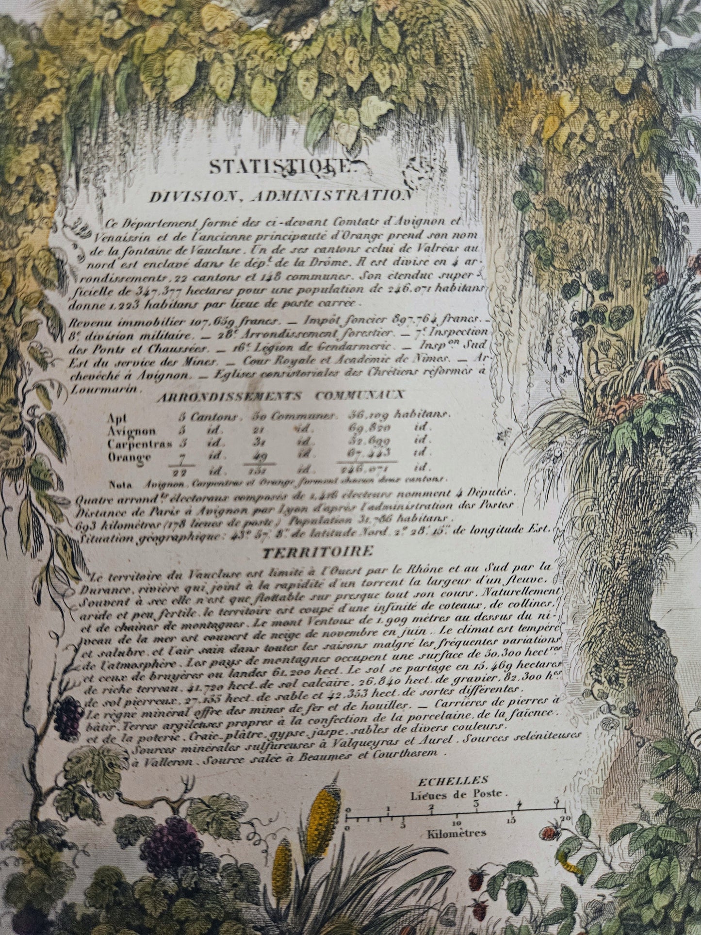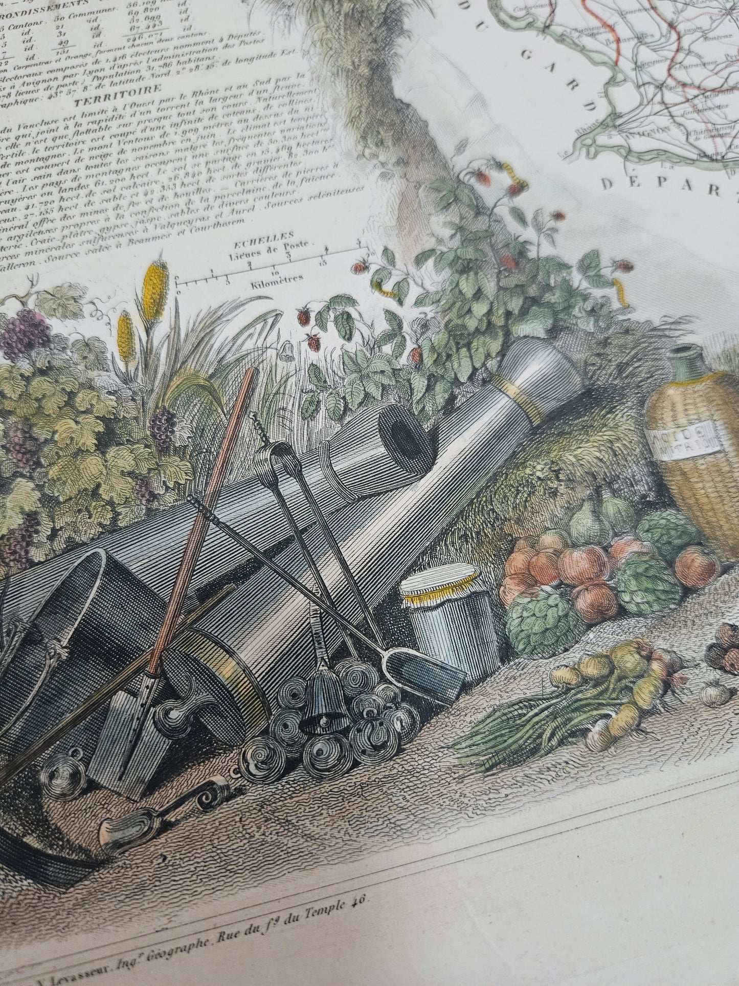


A beautiful representation of Dept. de Vaucluse from 1866 by the renowned French cartographer Victor Levasseur.
Victor Levasseur was a prominent cartographer known for his richly embellished maps of mid-19th Century France. Levasseur's maps often featured vignettes and allegorical figures, intricate borders with portraits of notable figures, scenes of local activities and symbols representing the area's agricultural and industrial strengths and visual interest, making them unique among his contemporaries.
This map appeared in the "Atlas National Illustré des 89 Départements et des Possessions de la France," a comprehensive work that showcased the French territories between 1847 and 1861. The atlas endorsed a sense of national identity after the Napoleonic era by showcasing the diversity and richness of the country during a period marked by considerable interest in national unity and territorial organisation.
This particular maps has been beautifully hand-coloured and is in excellent condition.
Details
- Date: 1866
- Author: Levasseur, V.; Paris, France
- Size: 42xm x 29cm
Condition
Excellent; Clear, dark print, extra-wide margins with excellent hand-colour. Unramed
1866 Levasseur - Dept. de Vaucluse
1866 Levasseur - Dept. de Vaucluse
Couldn't load pickup availability
1 in stock
A beautiful representation of Dept. de Vaucluse from 1866 by the renowned French cartographer Victor Levasseur.
Victor Levasseur was a prominent cartographer known for his richly embellished maps of mid-19th Century France. Levasseur's maps often featured vignettes and allegorical figures, intricate borders with portraits of notable figures, scenes of local activities and symbols representing the area's agricultural and industrial strengths and visual interest, making them unique among his contemporaries.
This map appeared in the "Atlas National Illustré des 89 Départements et des Possessions de la France," a comprehensive work that showcased the French territories between 1847 and 1861. The atlas endorsed a sense of national identity after the Napoleonic era by showcasing the diversity and richness of the country during a period marked by considerable interest in national unity and territorial organisation.
This particular maps has been beautifully hand-coloured and is in excellent condition.
Details
- Date: 1866
- Author: Levasseur, V.; Paris, France
- Size: 42xm x 29cm
Condition
Excellent; Clear, dark print, extra-wide margins with excellent hand-colour. Unramed