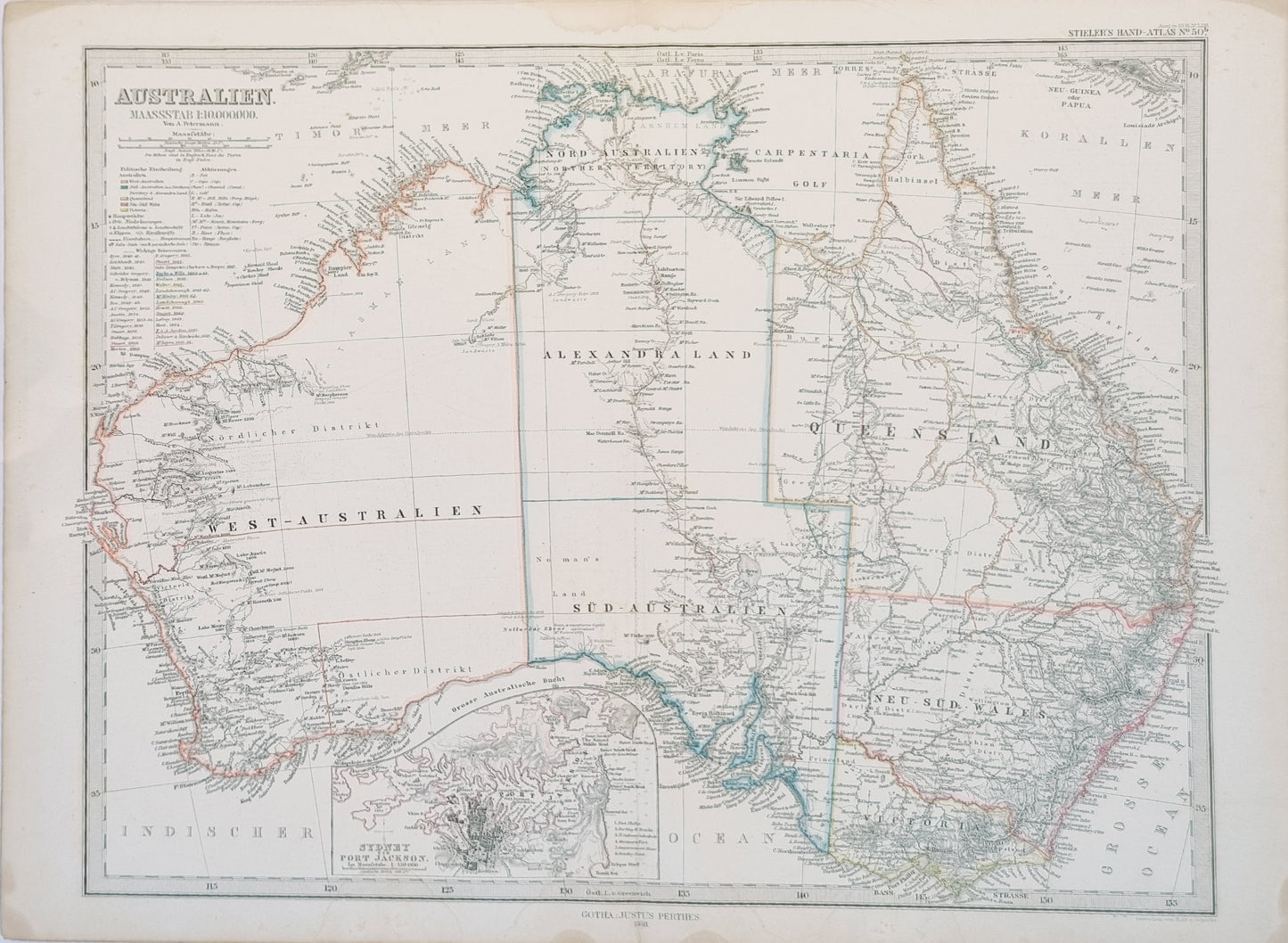


This meticulously detailed map, originating from Stieler's Hand-Atlas circa 1870, presents a comprehensive and exquisite depiction of 19th century Australia. Renowned for its precision, Stieler's maps of this period are celebrated for their fine engraving, detailed topographical information, and subtle yet distinctive hand coloring.
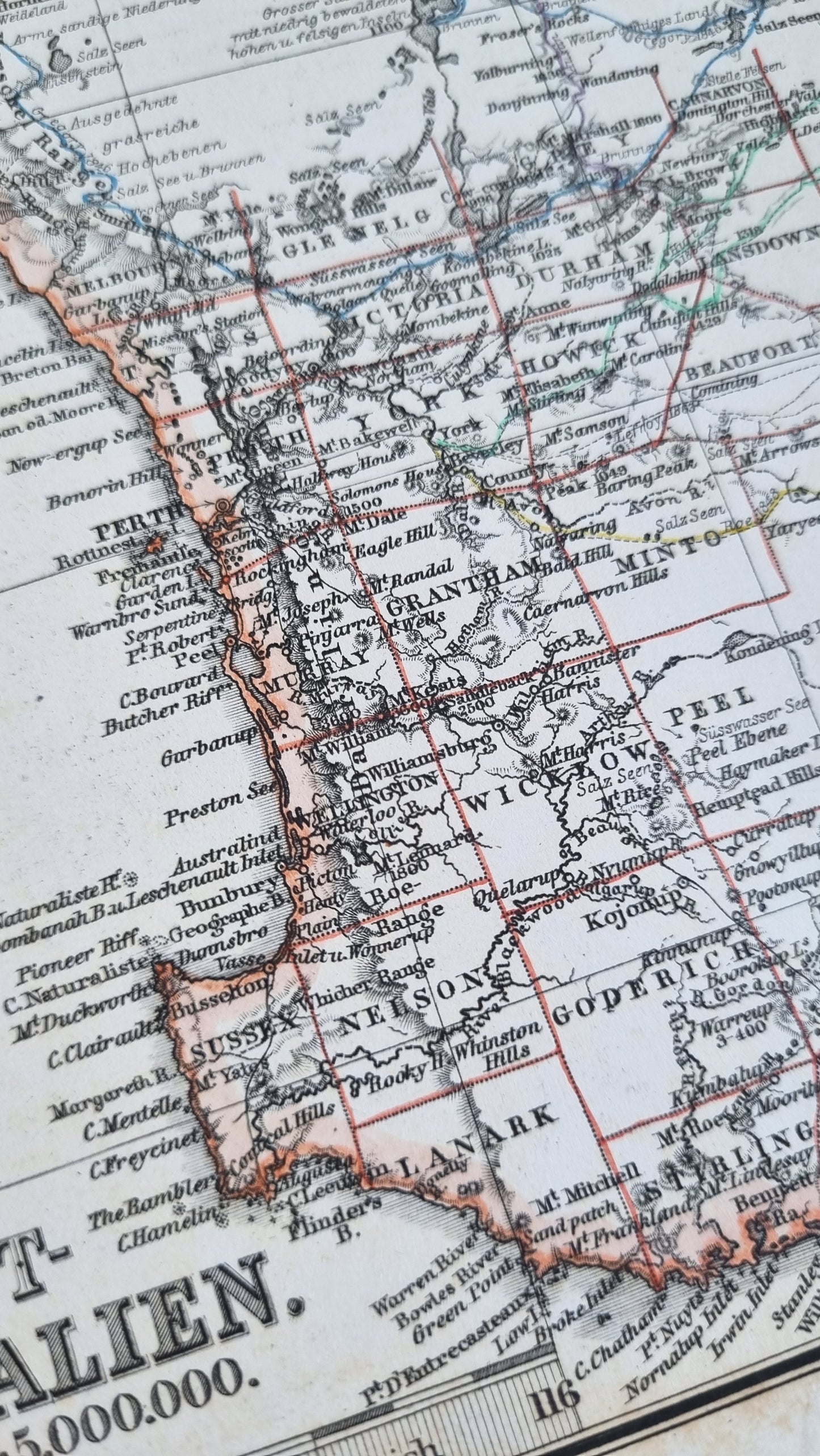
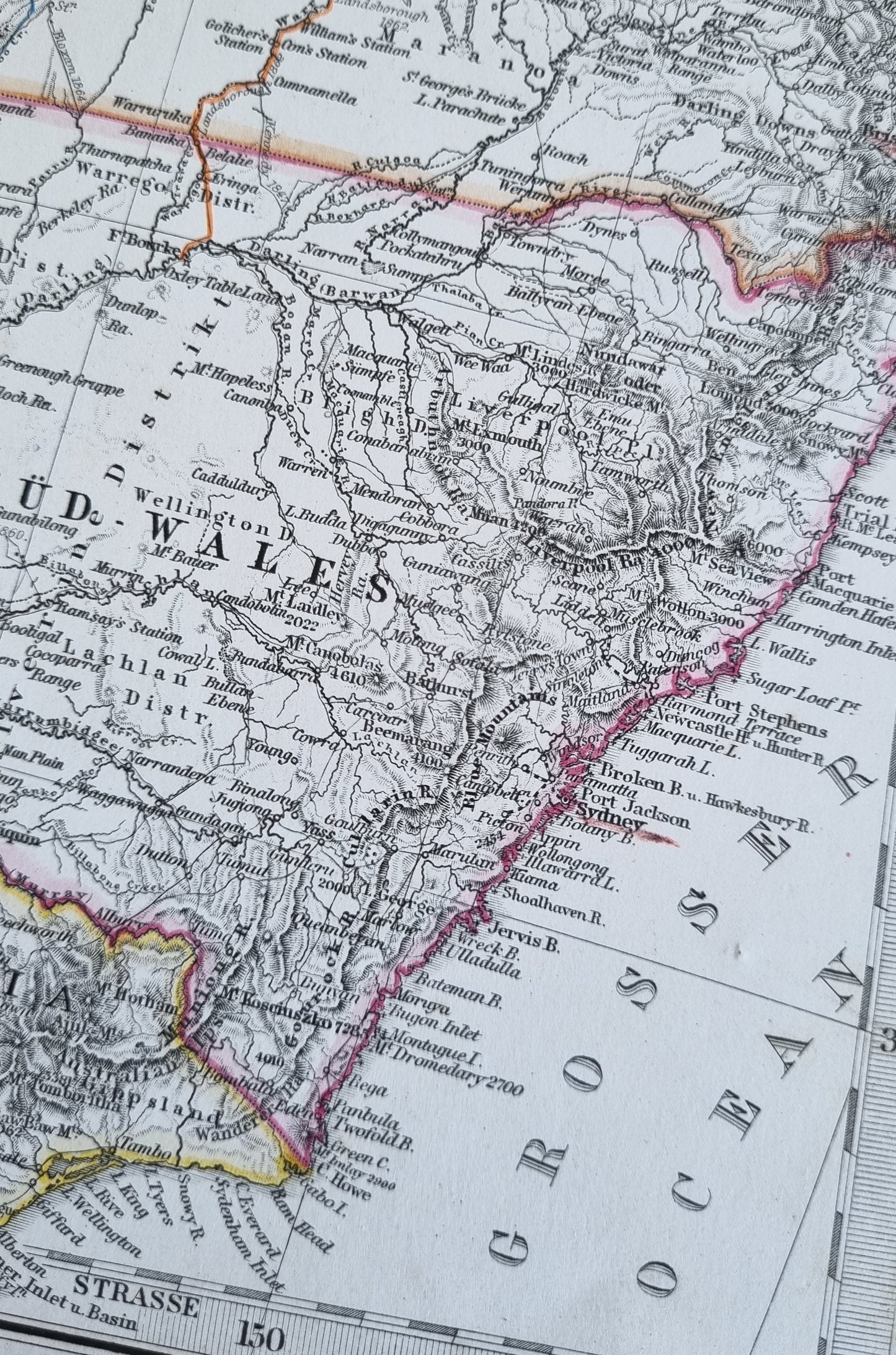
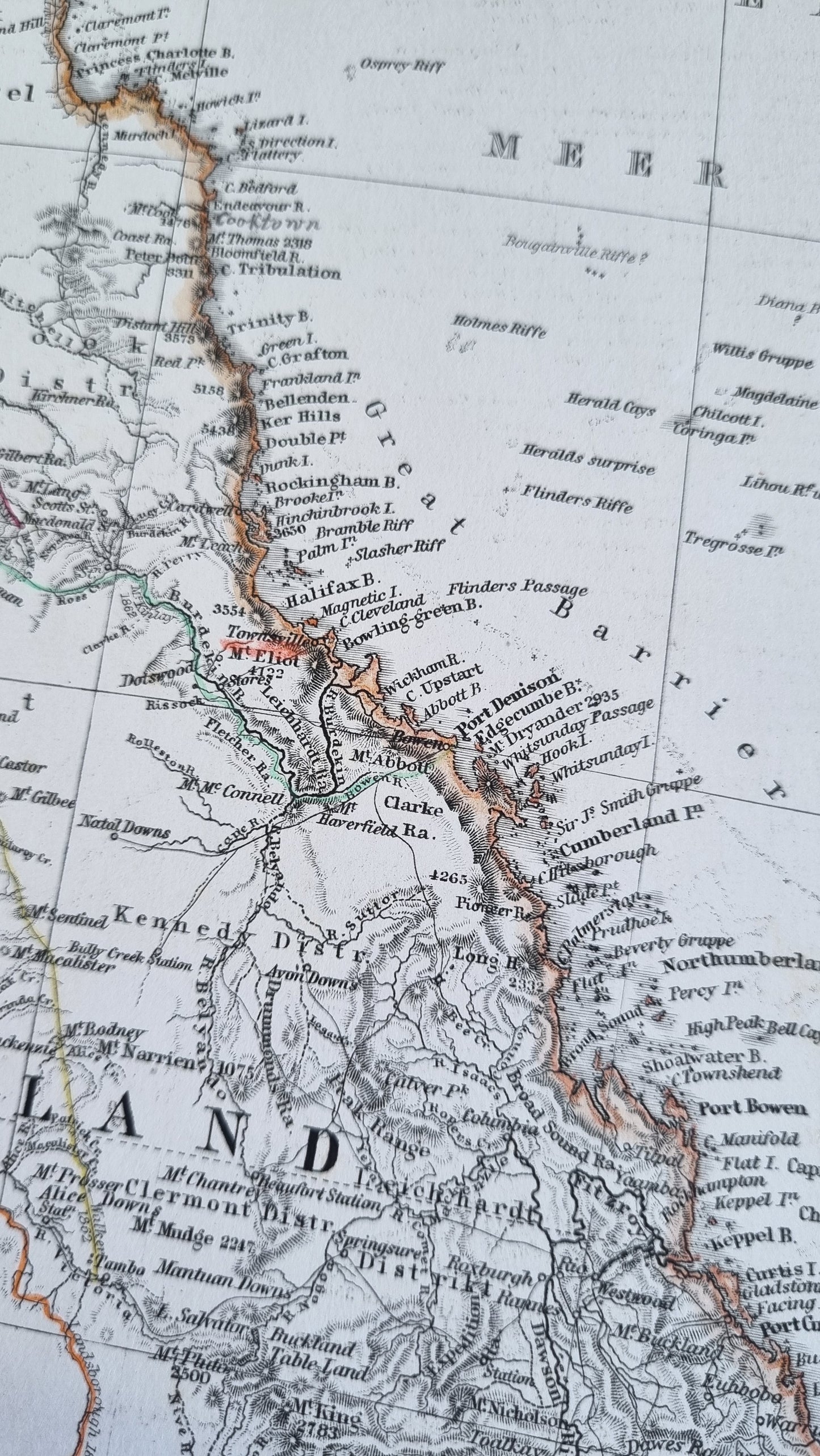
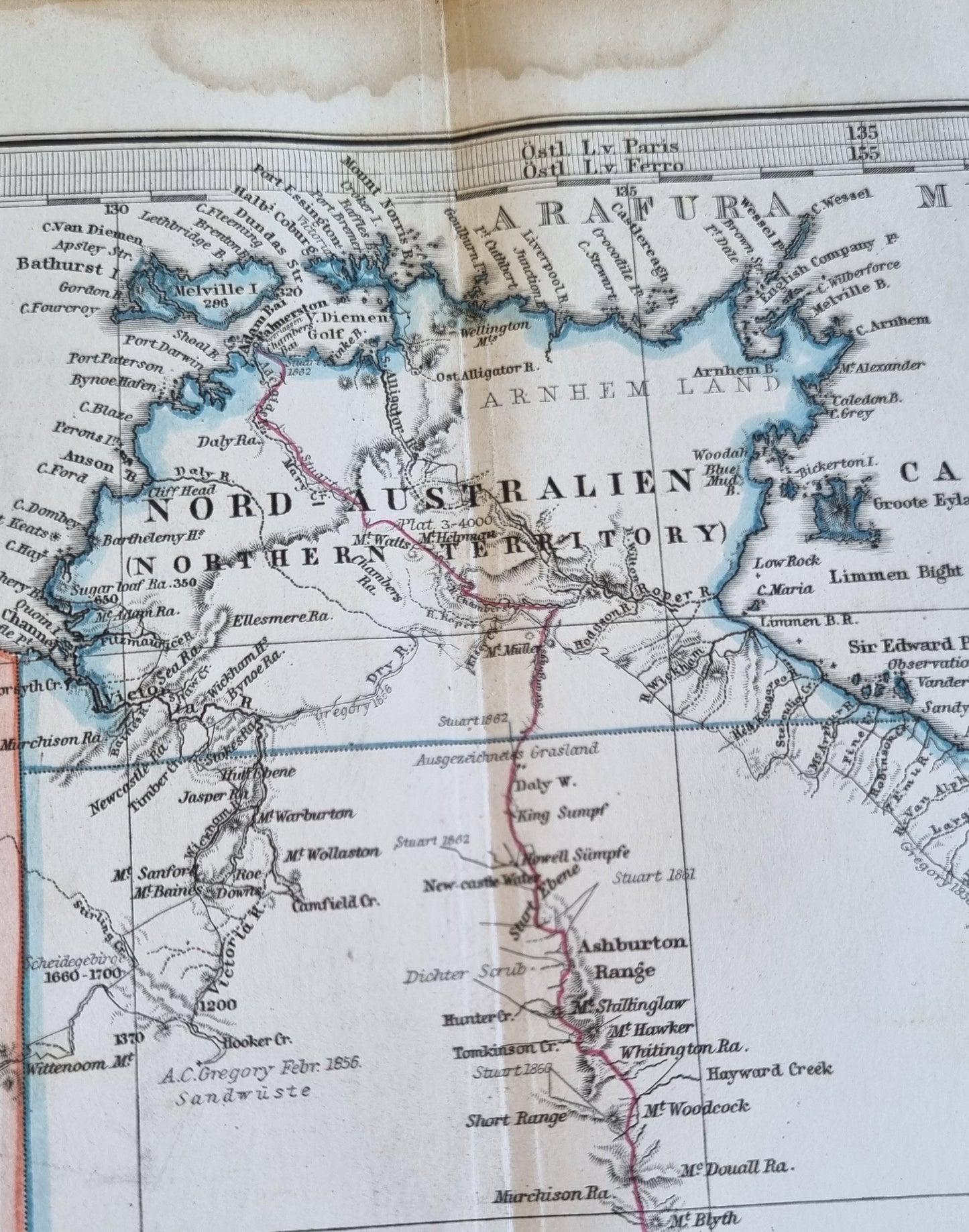
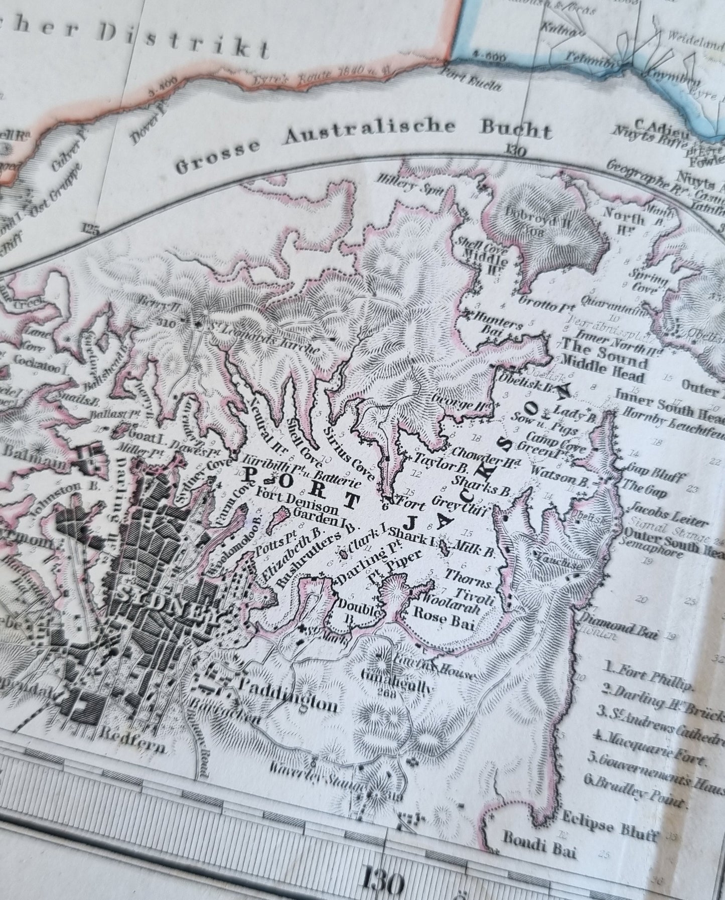
The map shows the states as their boundaries appeared at the time and includes numerous geographical details such as mountain ranges, river systems, and coastal lines. Subtle use of colour delineates state boundaries, with a gentle and consistent palette that remains vibrant despite its age. A prominent inset of Sydney Harbour is complete with urban outlines of the streets of Sydney and depth soundings of Port Jackson.
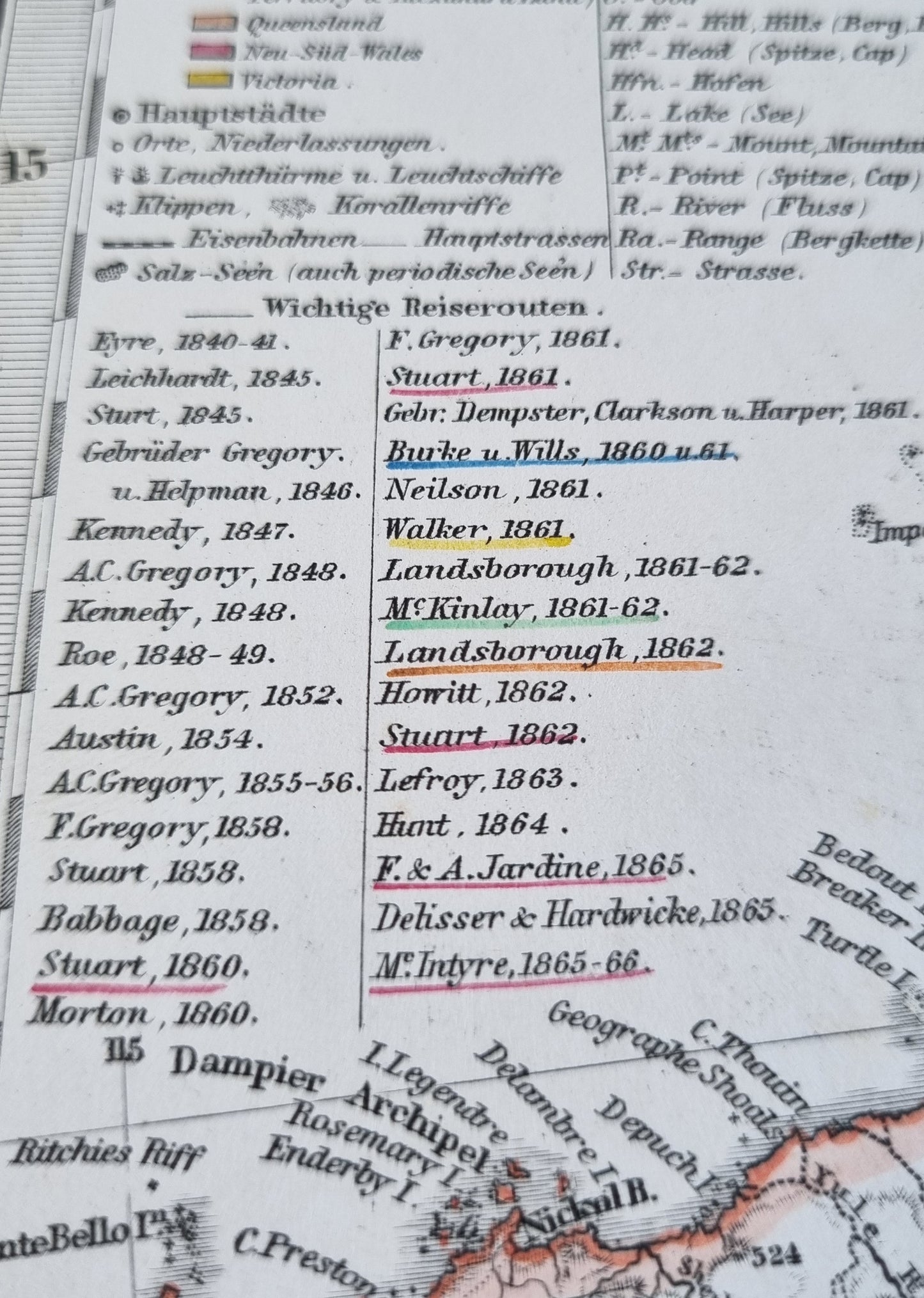
An interesting aspect of the map is the inclusion of key exploratory routes marked with the names of explorers and the years of their expeditions. This not only serves as a historical record of exploration but also adds to the map's historical importance, capturing a time of significant development and discovery in Australia's history.
Maps from Stieler's Hand-Atlas are widely recognized for their accuracy and detail, reflecting the scientific approach to cartography in the 19th century, particularly in Germany. Collectors and enthusiasts appreciate these maps not only as historical documents but also as works of art, with this particular map serving as a remarkable testament.
Details
- Date: 1867
- Author: Hermann Berghaus; Gotha, Germany
- Size: 48cm x 39cm
- Medium: Steel engraving with colours
Condition
Very Good; No tears and full margins on all sides. Dark print with bright colours. An example with excellent colour. Some light toning at the edges. Light brown bloom at top centre margin, not affecting the image. Centre fold as issued.
Unframed.
1867 Australia
1867 Australia
Couldn't load pickup availability
Out of stock
This meticulously detailed map, originating from Stieler's Hand-Atlas circa 1870, presents a comprehensive and exquisite depiction of 19th century Australia. Renowned for its precision, Stieler's maps of this period are celebrated for their fine engraving, detailed topographical information, and subtle yet distinctive hand coloring.
The map shows the states as their boundaries appeared at the time and includes numerous geographical details such as mountain ranges, river systems, and coastal lines. Subtle use of colour delineates state boundaries, with a gentle and consistent palette that remains vibrant despite its age. A prominent inset of Sydney Harbour is complete with urban outlines of the streets of Sydney and depth soundings of Port Jackson.
An interesting aspect of the map is the inclusion of key exploratory routes marked with the names of explorers and the years of their expeditions. This not only serves as a historical record of exploration but also adds to the map's historical importance, capturing a time of significant development and discovery in Australia's history.
Maps from Stieler's Hand-Atlas are widely recognized for their accuracy and detail, reflecting the scientific approach to cartography in the 19th century, particularly in Germany. Collectors and enthusiasts appreciate these maps not only as historical documents but also as works of art, with this particular map serving as a remarkable testament.
Details
- Date: 1867
- Author: Hermann Berghaus; Gotha, Germany
- Size: 48cm x 39cm
- Medium: Steel engraving with colours
Condition
Very Good; No tears and full margins on all sides. Dark print with bright colours. An example with excellent colour. Some light toning at the edges. Light brown bloom at top centre margin, not affecting the image. Centre fold as issued.
Unframed.