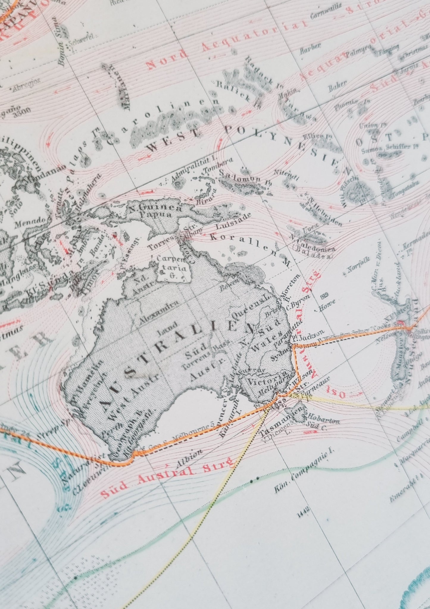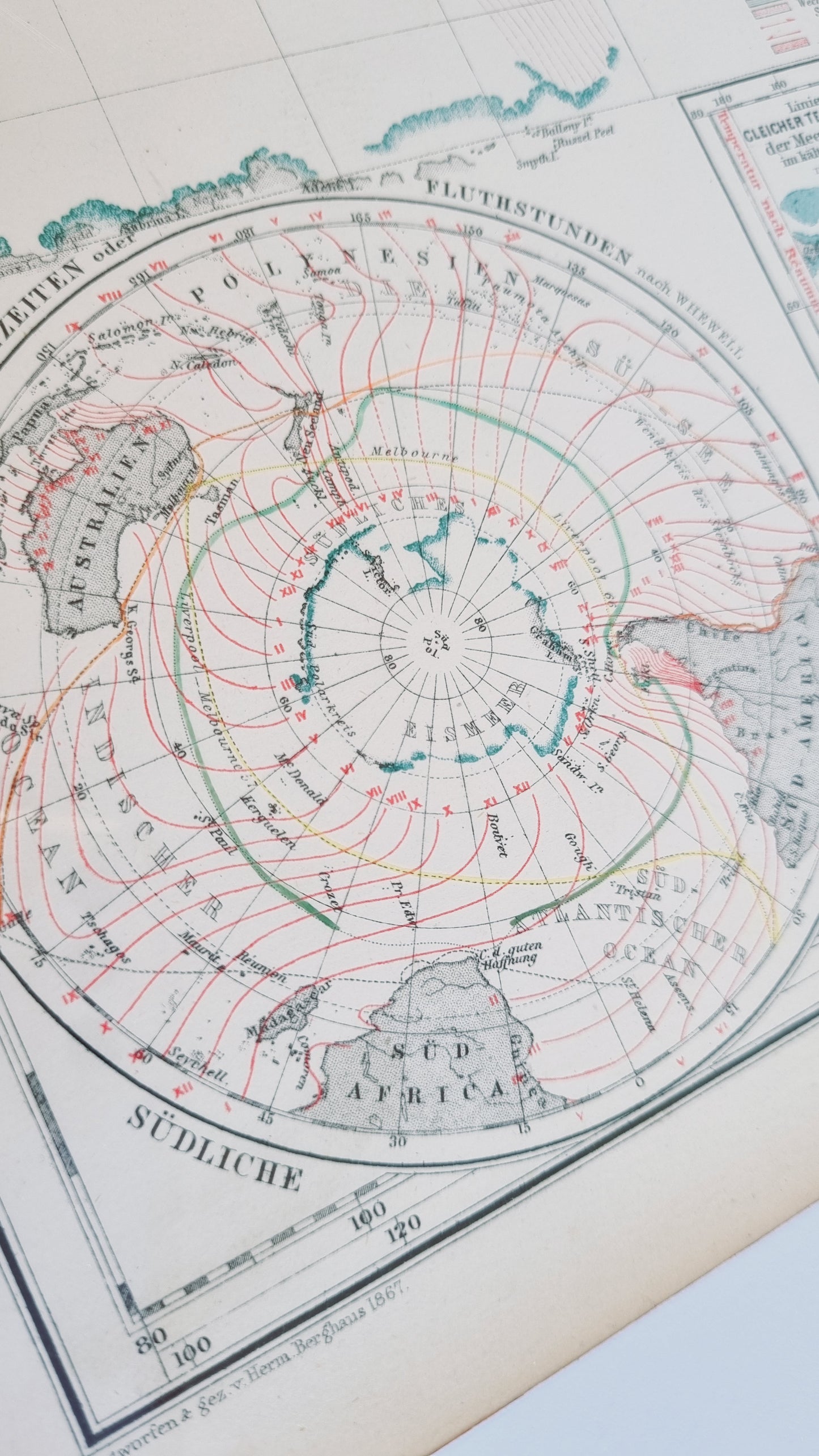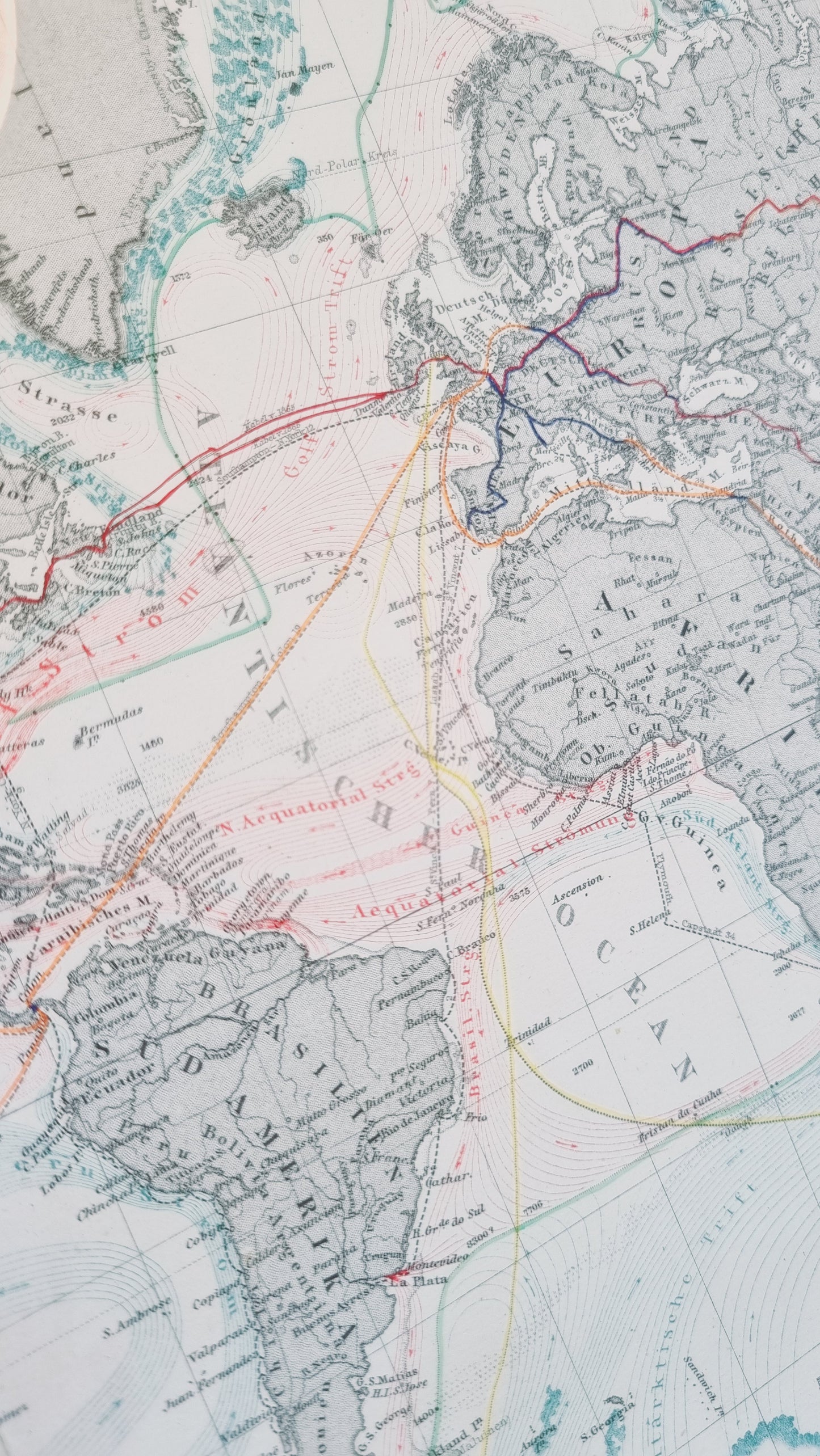


A rich representation of 19th-century world geography with an emphasis on maritime details, major sea trading routes, oceanic currents and tides.
A world map by Hermann Berhaus, German cartographer from the 19th Century, published by the Justus Perthes publishing house located in Gotha, Germany.
Details
- Date: 1867
- Author: Hermann Berhaus; Gotha, Germany
- Size: 48cm x 39cm
Condition
Excellent; No tears or staining and full margins on all sides. Dark print with bright colours. Some light yellowing around margins.
Unframed.
1867 World Map of Sea Currents and Trade
1867 World Map of Sea Currents and Trade
Couldn't load pickup availability
Out of stock
A rich representation of 19th-century world geography with an emphasis on maritime details, major sea trading routes, oceanic currents and tides.
A world map by Hermann Berhaus, German cartographer from the 19th Century, published by the Justus Perthes publishing house located in Gotha, Germany.
Details
- Date: 1867
- Author: Hermann Berhaus; Gotha, Germany
- Size: 48cm x 39cm
Condition
Excellent; No tears or staining and full margins on all sides. Dark print with bright colours. Some light yellowing around margins.
Unframed.