


This map, featured in Stieler's Hand-Atlas in 1869, depicts Denmark along with Schleswig, Holstein and Lauenburg and the Danish Colonies. The duchies mentioned have a complex history, especially in the 19th century, involving conflicts and varying sovereignties between Denmark and what later became Germany.
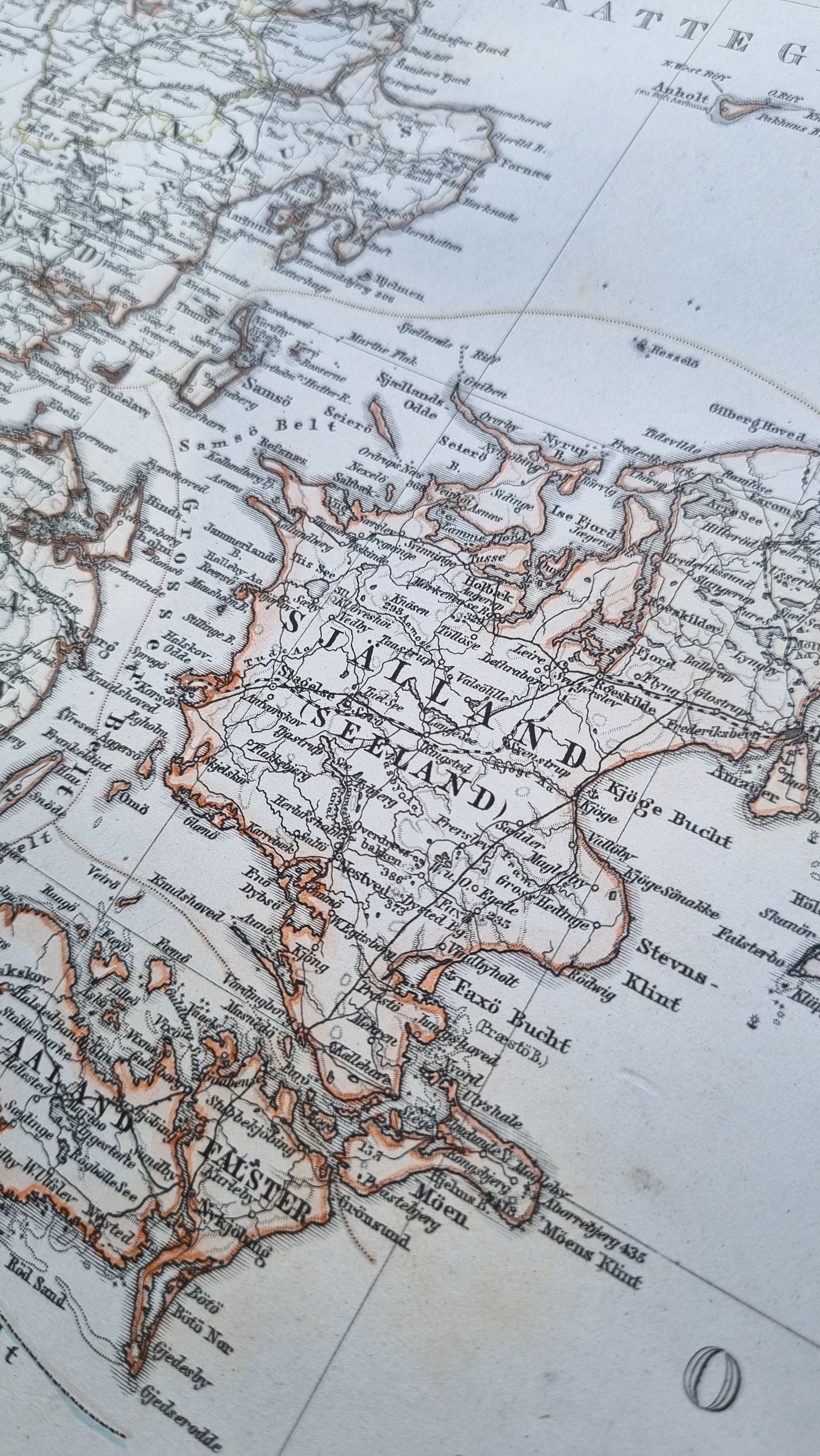
A prime example of 19th-century European cartography, it showcases Stieler's renowned precision and attention to detail. The map is color-coded, with Denmark's counties outlined in various hues, and the seas, including the Kattegat and Skagerrak, shaded in light blue. Topographical features like mountain ranges are meticulously rendered.
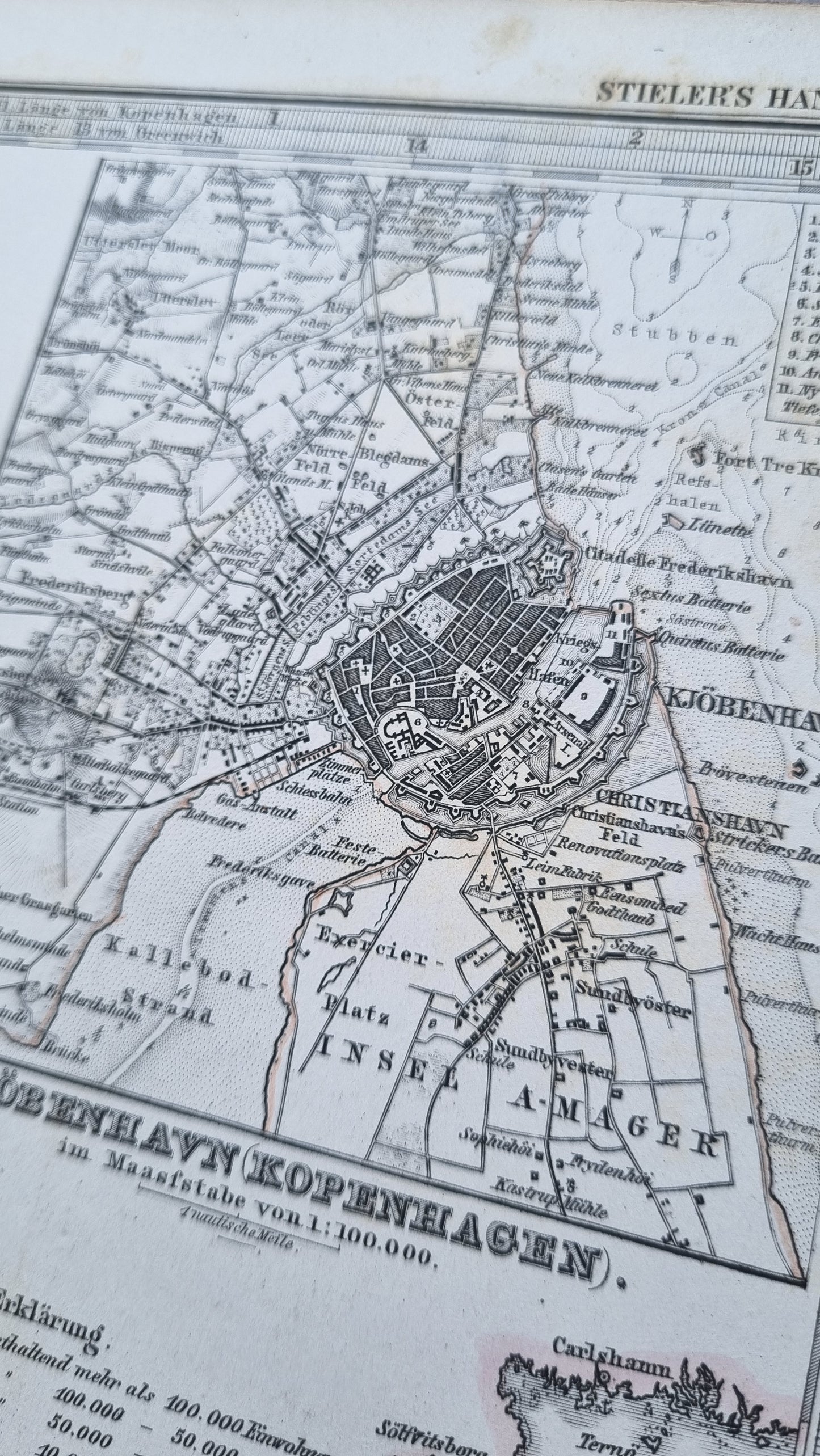
Inset maps show detailed plans of Iceland and the Faroe Islands, as well as a more focused map of Copenhagen, highlighting the city's fortifications and urban layout. These insets not only enhance the geographical context but also serve as snapshots of the urban planning of the time.
The map’s aesthetic appeal lies in its fine engravings and balanced composition. Collectors may find the juxtaposition of the rugged Icelandic terrain against the structured Danish peninsula particularly appealing. Furthermore, the detailed depiction of the bustling port and the capital city of Copenhagen would captivate those interested in urban development and maritime history. It represents a period of European history when cartography was as much an art as it was a science.
Details
- Date: 1869
- Author: A Petermann; Gotha, Germany
- Size: 48cm x 39cm
- Medium: Steel engraving
Condition
Very Good; Slight dark toning to edges and light foxing towards the margins. Clear, dark print with subtle colours.
Unframed.
1869 Denmark
1869 Denmark
Couldn't load pickup availability
1 in stock
This map, featured in Stieler's Hand-Atlas in 1869, depicts Denmark along with Schleswig, Holstein and Lauenburg and the Danish Colonies. The duchies mentioned have a complex history, especially in the 19th century, involving conflicts and varying sovereignties between Denmark and what later became Germany.
A prime example of 19th-century European cartography, it showcases Stieler's renowned precision and attention to detail. The map is color-coded, with Denmark's counties outlined in various hues, and the seas, including the Kattegat and Skagerrak, shaded in light blue. Topographical features like mountain ranges are meticulously rendered.
Inset maps show detailed plans of Iceland and the Faroe Islands, as well as a more focused map of Copenhagen, highlighting the city's fortifications and urban layout. These insets not only enhance the geographical context but also serve as snapshots of the urban planning of the time.
The map’s aesthetic appeal lies in its fine engravings and balanced composition. Collectors may find the juxtaposition of the rugged Icelandic terrain against the structured Danish peninsula particularly appealing. Furthermore, the detailed depiction of the bustling port and the capital city of Copenhagen would captivate those interested in urban development and maritime history. It represents a period of European history when cartography was as much an art as it was a science.
Details
- Date: 1869
- Author: A Petermann; Gotha, Germany
- Size: 48cm x 39cm
- Medium: Steel engraving
Condition
Very Good; Slight dark toning to edges and light foxing towards the margins. Clear, dark print with subtle colours.
Unframed.