


A collection of two maps from Stieler's Hand Atlas, dated 1869, encapsulating the geographical understanding of the world during the Industrial Age.
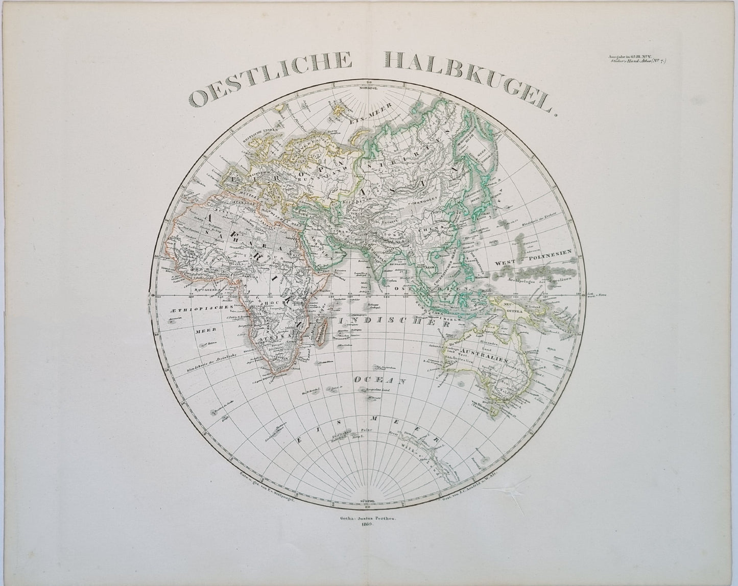
The Eastern Hemisphere map, titled "Oestliche Halbkugel," presents Europe, Asia, Africa, and Australia. Notable is the delineation of colonial territories, such as the expansive British holdings in India. The Australian continent is depicted with significant detail along the coast, with interior regions less defined.
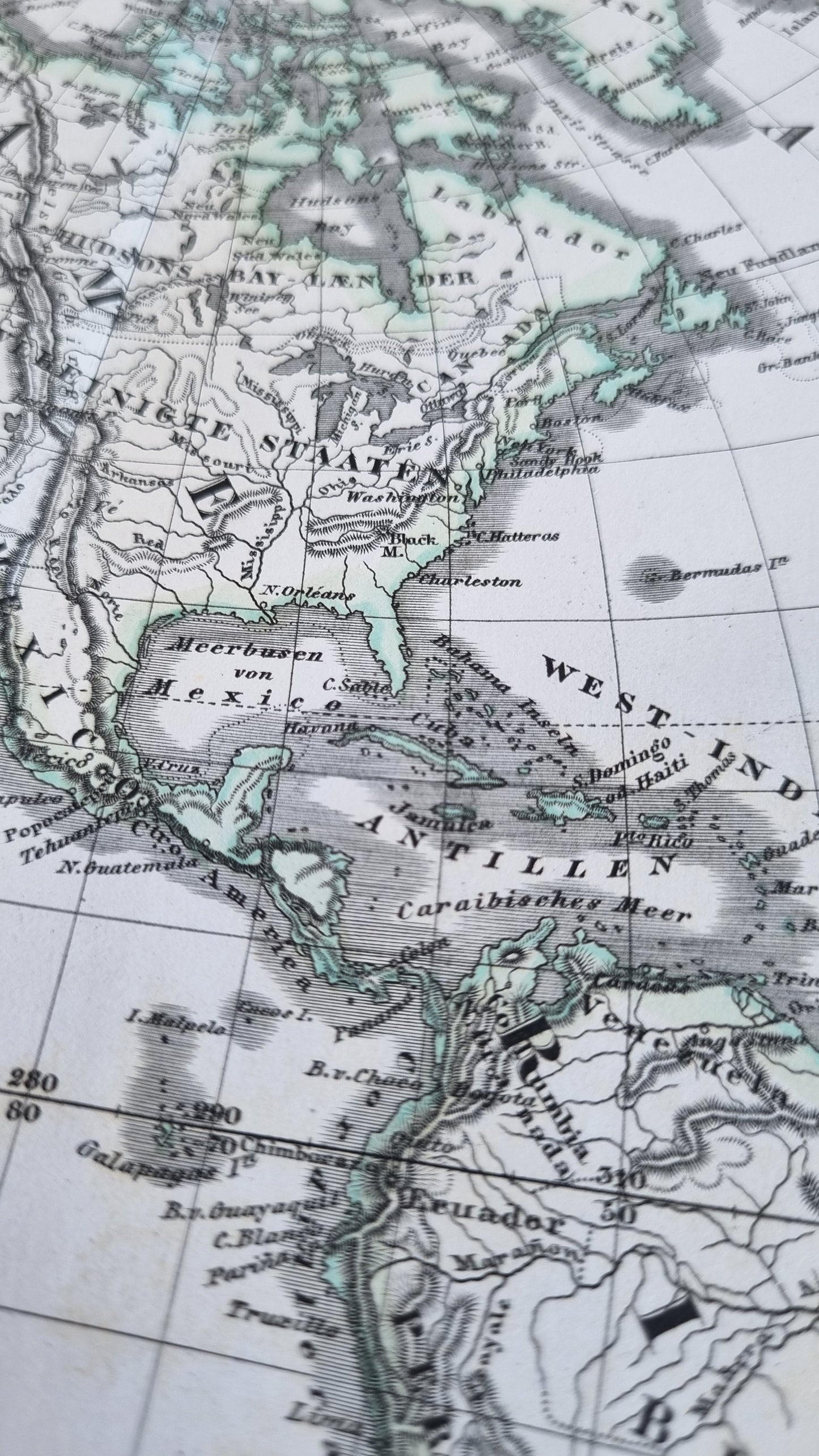
The Western Hemisphere map, "Westliche Halbkugel," displays the Americas and the Pacific Ocean. The map offers a snapshot of the United States post-Civil War, with a fully integrated national territory, and the Alaska territory not long after its purchase from Russia in 1867.
Aesthetically, these maps are prime examples of 19th-century cartography with their fine lithographic print and delicate hand colouring.
1869 World Hemispheres
1869 World Hemispheres
Regular price
$189.00 AUD
Regular price
Sale price
$189.00 AUD
Unit price
per
Shipping calculated at checkout.
Couldn't load pickup availability
Out of stock
A collection of two maps from Stieler's Hand Atlas, dated 1869, encapsulating the geographical understanding of the world during the Industrial Age.
The Eastern Hemisphere map, titled "Oestliche Halbkugel," presents Europe, Asia, Africa, and Australia. Notable is the delineation of colonial territories, such as the expansive British holdings in India. The Australian continent is depicted with significant detail along the coast, with interior regions less defined.
The Western Hemisphere map, "Westliche Halbkugel," displays the Americas and the Pacific Ocean. The map offers a snapshot of the United States post-Civil War, with a fully integrated national territory, and the Alaska territory not long after its purchase from Russia in 1867.
Aesthetically, these maps are prime examples of 19th-century cartography with their fine lithographic print and delicate hand colouring.