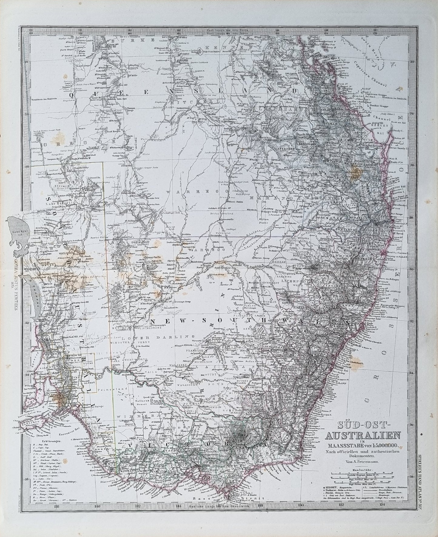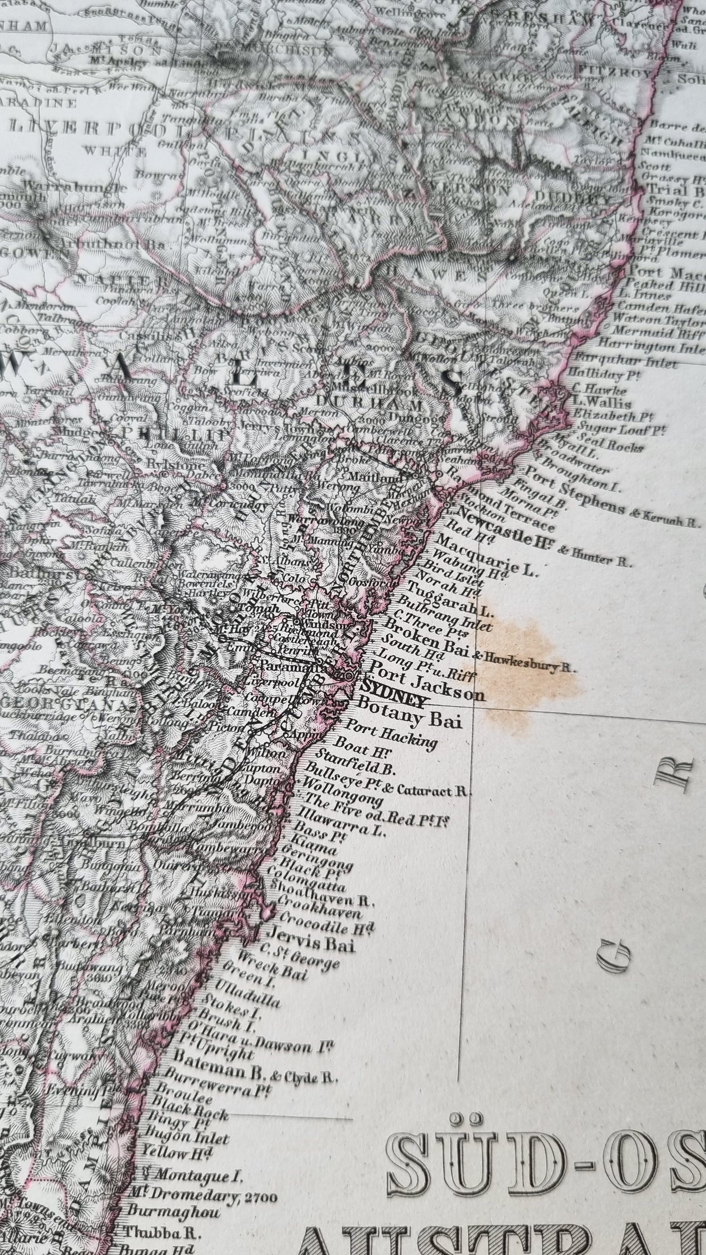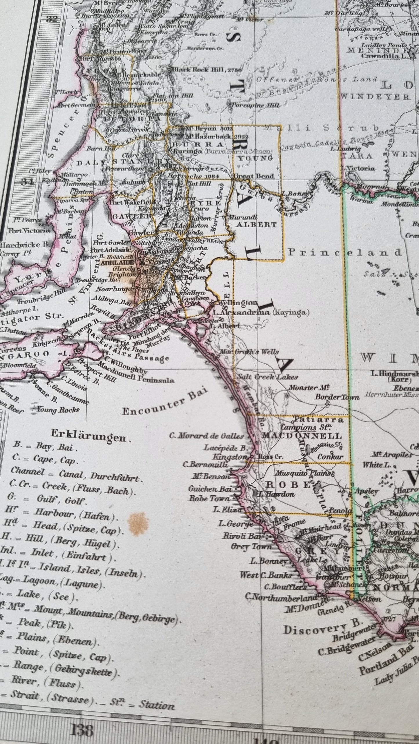


A detailed representation of South-Eastern Australia, attributed to the esteemed cartographer August Heinrich Petermann and featured in Stieler's Hand Atlas. The map covers a large portion of South-Eastern Australia, detailing regions such as New South Wales and parts of Victoria with an impressive degree of precision in its representation of townships, roads, topographical features, and railway lines, which were pivotal to the area's development during the era.
Details
- Date: 1870
- Author: Von. A. Petermann; Gotha, Germany
- Size: 48cm x 39cm
Condition
Good. Foxing and brown marks affecting some portions of the printed image. Otherwise a dark print with original colour.
Unframed
1870 South East Australia
1870 South East Australia
Couldn't load pickup availability
1 in stock
A detailed representation of South-Eastern Australia, attributed to the esteemed cartographer August Heinrich Petermann and featured in Stieler's Hand Atlas. The map covers a large portion of South-Eastern Australia, detailing regions such as New South Wales and parts of Victoria with an impressive degree of precision in its representation of townships, roads, topographical features, and railway lines, which were pivotal to the area's development during the era.
Details
- Date: 1870
- Author: Von. A. Petermann; Gotha, Germany
- Size: 48cm x 39cm
Condition
Good. Foxing and brown marks affecting some portions of the printed image. Otherwise a dark print with original colour.
Unframed