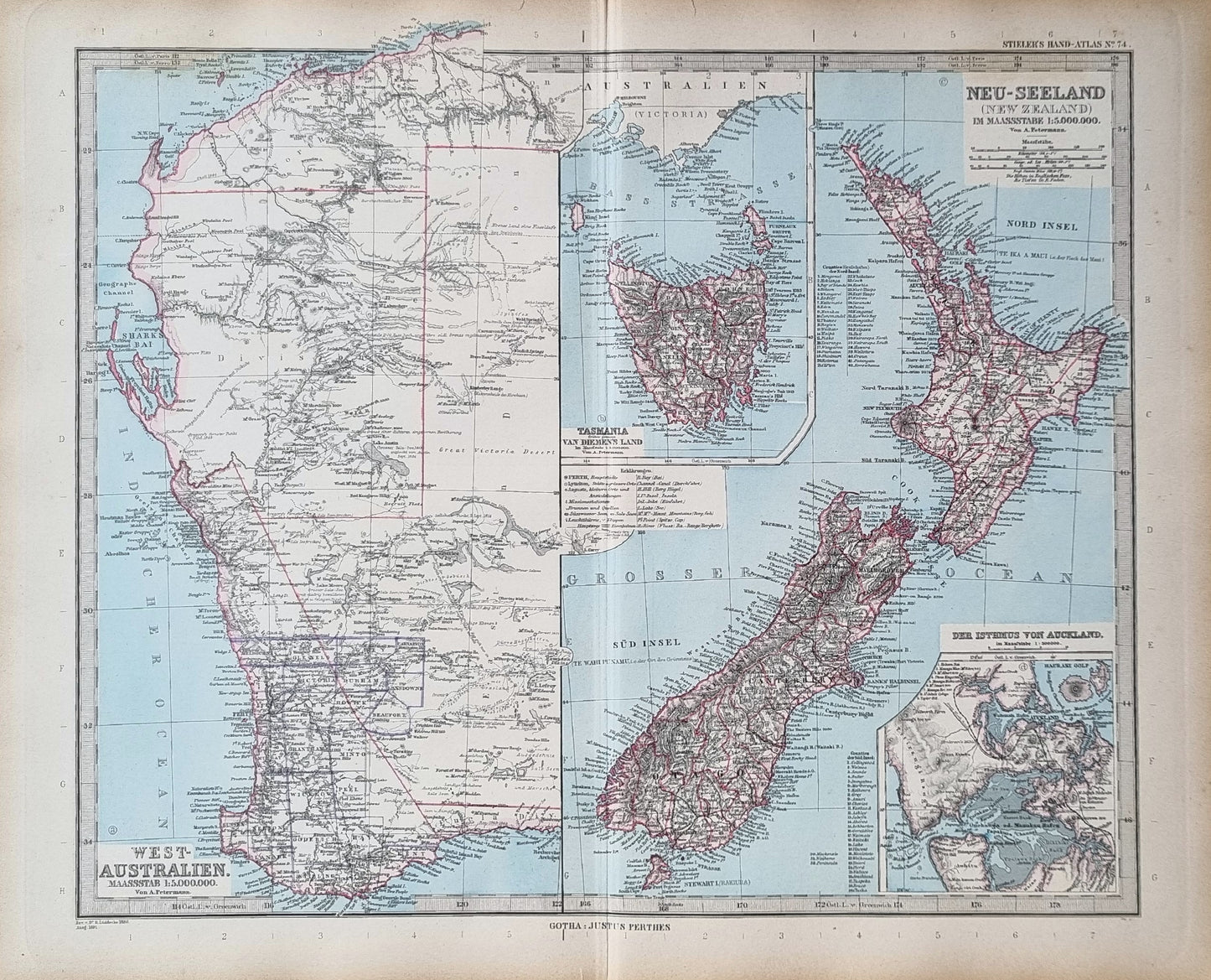


A distinguished map ensemble by Von. A. Petermann from Stieler's Hand Atlas, dated 1891, illustrating the significant geographies of New Zealand, Western Australia, and Tasmania.
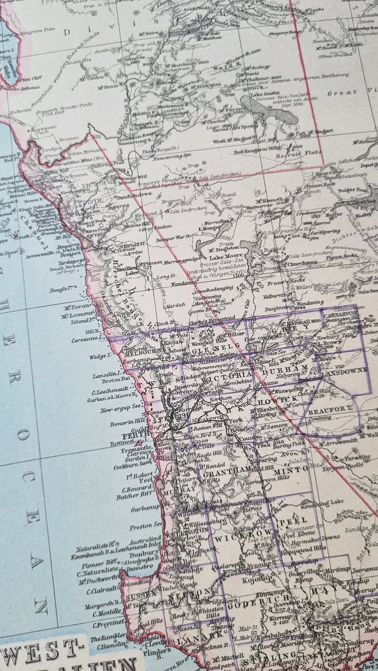
The map detailing Tasmania, then known as Van Diemen's Land, along with Western Australia, showcases an era of exploration and colonial expansion. Significant rivers, lakes and exploration routes of the vast expanse of Western Australia are outlined, with accompanying notes in German. Fine lithography, with hand-colored outlines, delineates the rugged coastlines, river systems, and the evolving settlement patterns of the mid-19th century. The inclusion of transportation routes and topographical features makes this map not only a visual delight but also a document of historical and educational value.
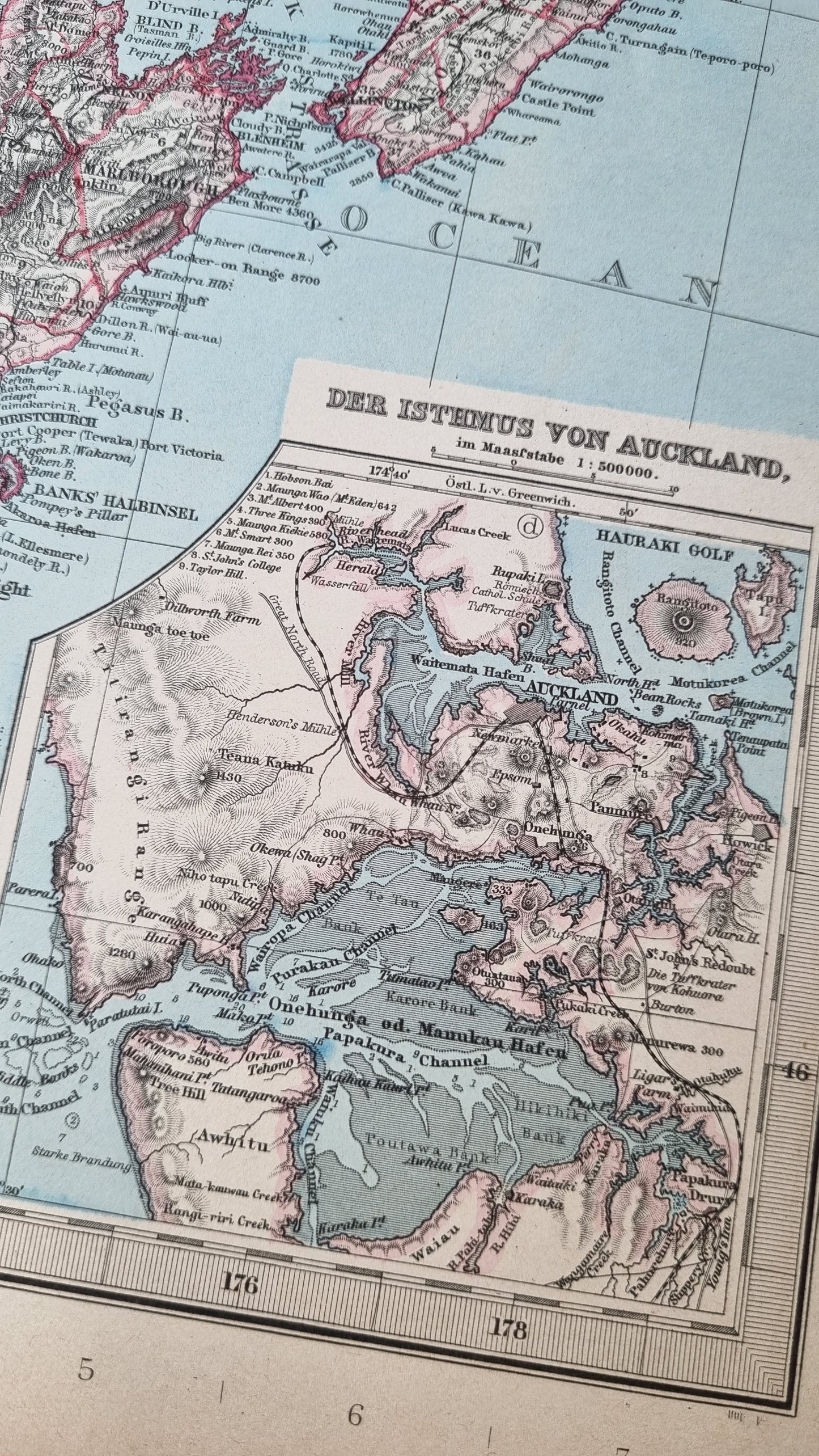
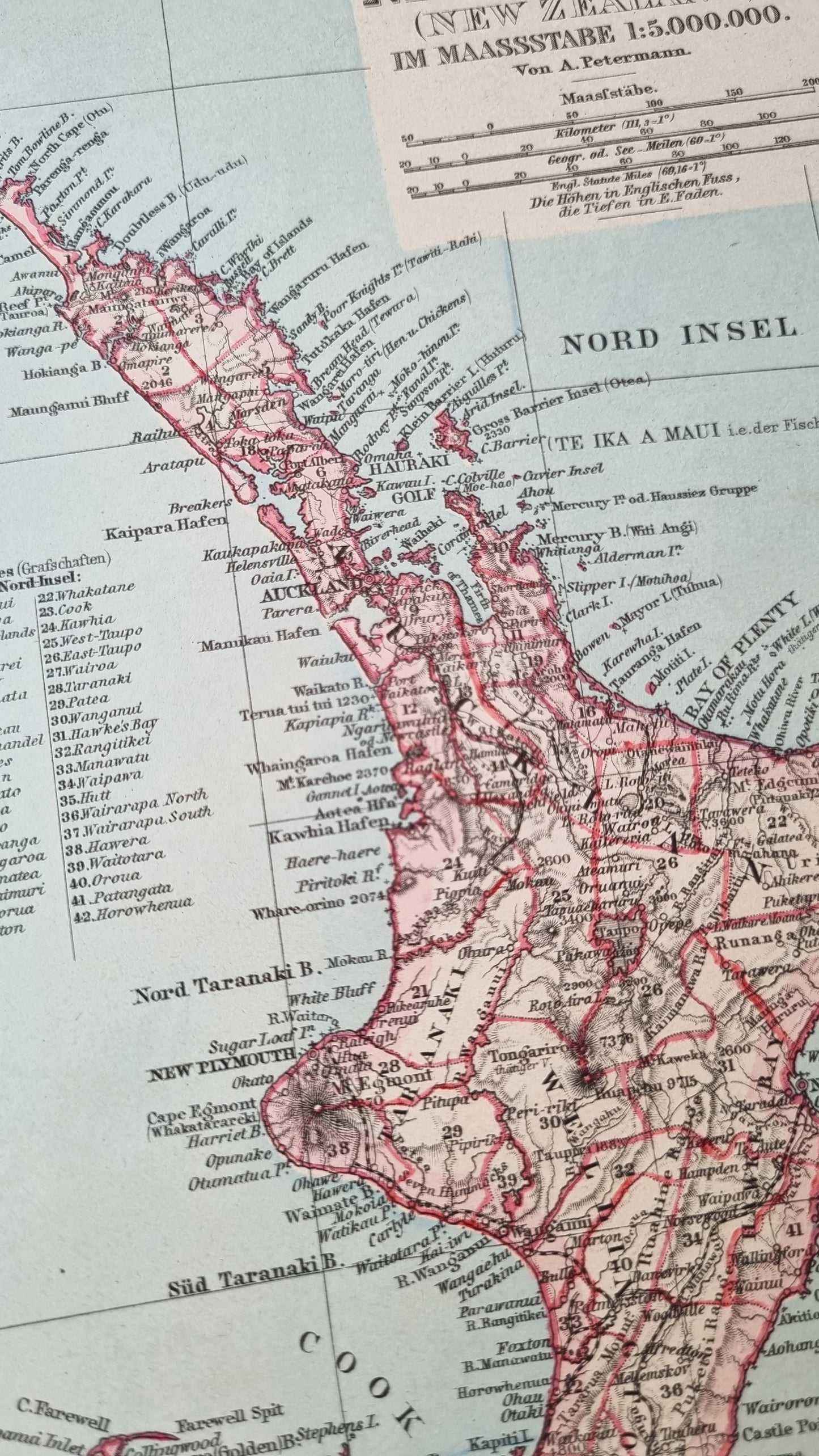
The plate of New Zealand captures both the North and South Islands with remarkable precision. The inset of the Isthmus of Auckland, featuring the Hauraki Gulf, further accentuates the strategic detail invested in urban and natural landscapes. These maps are distinguished by their clarity and the depth of geographical information, from mountain ranges like the Southern Alps to the intricate fjord systems.
Details
- Date: 1891
- Author: A Petermann; Gotha, Germany
- Size: 48cm x 39cm
- Medium: Steel engraving with hand-colour
Condition
Excellent; No tears and full margins on all sides. Dark print with bright colours. Some light toning at the edges Unframed
1891 New Zealand, WA and Tasmania
1891 New Zealand, WA and Tasmania
Couldn't load pickup availability
1 in stock
A distinguished map ensemble by Von. A. Petermann from Stieler's Hand Atlas, dated 1891, illustrating the significant geographies of New Zealand, Western Australia, and Tasmania.
The map detailing Tasmania, then known as Van Diemen's Land, along with Western Australia, showcases an era of exploration and colonial expansion. Significant rivers, lakes and exploration routes of the vast expanse of Western Australia are outlined, with accompanying notes in German. Fine lithography, with hand-colored outlines, delineates the rugged coastlines, river systems, and the evolving settlement patterns of the mid-19th century. The inclusion of transportation routes and topographical features makes this map not only a visual delight but also a document of historical and educational value.
The plate of New Zealand captures both the North and South Islands with remarkable precision. The inset of the Isthmus of Auckland, featuring the Hauraki Gulf, further accentuates the strategic detail invested in urban and natural landscapes. These maps are distinguished by their clarity and the depth of geographical information, from mountain ranges like the Southern Alps to the intricate fjord systems.
Details
- Date: 1891
- Author: A Petermann; Gotha, Germany
- Size: 48cm x 39cm
- Medium: Steel engraving with hand-colour
Condition
Excellent; No tears and full margins on all sides. Dark print with bright colours. Some light toning at the edges Unframed